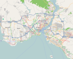
Tophane
| Tophane | |
|---|---|
| Neighborhood | |

Tophane skyline seen from Bosphorus
|
|
| Coordinates: 41°01′39″N 28°58′56″E / 41.02739°N 28.98228°ECoordinates: 41°01′39″N 28°58′56″E / 41.02739°N 28.98228°E | |
| Country |
|
| Region | Marmara |
| Province | Istanbul |
| District | Beyoğlu |
| Time zone | EET (UTC+2) |
| • Summer (DST) | EEST (UTC+3) |
| Postal code | 34425 |
| Area code | 0-212 |
Tophane is a neighborhood in the Beyoğlu district of Istanbul, Turkey. It has a coastline with the Bosporus. In the Ottoman era it was the city's oldest industrial zone.
The name of the place was derived from the armory known as Tophane-i Amire (Ottoman Turkish: توپخانه امیری; English: Imperial armory), which was built in the reign (1451–1481) of Ottoman Sultan Mehmed II. Its main purpose was the manufacturing cannons and cannonballs. Tophane, which could be seen in Melling's (1763–1831) engraving, has not been able to survive to this day. In 1823, during the Firuz Agha fire, the barracks were burned down only to be rebuilt later. In addition to this, during the reconstruction effort, the Nusretiye Mosque was constructed. The oldest remaining military buildings within Tophane were the old General Staff Headquarters and the industry barracks. Both were taken down due to construction to widen the road in 1958. In the place of the barracks, all that is remaining now is the historical clock tower and Mecidiye Mansion.
The Kılıç Ali Pasha Complex in Tophane, built by the Ottoman Kapudan-i Derya Kılıç Ali Pasha and designed by the renowned architect Mimar Sinan, is a külliye (group of buildings) which comprises a mosque, a medrese, a hamam, a türbe, and a fountain that were constructed between 1578 and 1587.
...
Wikipedia

