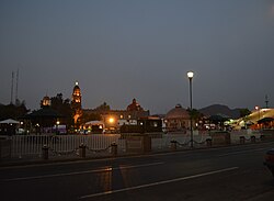
Tlalnepantla de Baz
| Tlalnepantla de Baz | |
|---|---|
| City & Municipality | |
 |
|
| Nickname(s): Tlalne or Tlane | |
| Motto: Culture, Work and Progress | |
 Location of Tlalnepantla in the State of Mexico |
|
| Coordinates: 19°32′12″N 99°11′41″W / 19.53667°N 99.19472°WCoordinates: 19°32′12″N 99°11′41″W / 19.53667°N 99.19472°W | |
| Country |
|
| State |
|
| Region | Tlalnepantla |
| Metro area | Greater Mexico City |
| Municipal Status | September 13, 1948 |
| Municipal Seat | Tlalnepantla |
| Government | |
| • Type | Ayuntamiento |
| • Municipal President | Guillermo Alfredo Martínez González |
| Area | |
| • Total | 83.48 km2 (32.23 sq mi) |
| • Land | 77.17 km2 (29 sq mi) |
| • Water | 1.10 km2 (3.28 sq mi) |
| Elevation | 2,250 m (7,380 ft) |
| Population (2010 Census) | |
| • Total | 664,225 |
| Time zone | CST (UTC-6) |
| • Summer (DST) | CDT (UTC-5) |
| Postal code (of seat) | 54000 |
| Area code(s) | 55 |
| Demonym | Tlalnepantlense |
| Website | Official website (Spanish) |
Tlalnepantla de Baz (better known as Tlalnepantla, and incorrectly called "Tlanepantla") is a city and a municipality of the state of Mexico, north of Mexico City (Ciudad de Mexico). Tlalnepantla comes from the Náhuatl words tlalli (land) and nepantla (middle) to mean the middle land. The city was known in prior times as Tlalnepantla de Galeana and Tlalnepantla de Comonfort, to honor Hermenegildo Galeana and Ignacio Comonfort, respectively. The current addition of Baz comes from the last name of Gustavo Baz Prada, an important politician and soldier of Emiliano Zapata's army during the Mexican Revolution. After the Revolution, Baz Prada became Governor of the State of Mexico and President of the National Autonomous University of Mexico (UNAM). It is located in the northeastern part of the state of Mexico, in the Valley of Mexico north of Mexico City proper. Together with Atizapan, it comprises the dense Region XII (Mexico State) of Mexico State.
Around the 11th century, a people called the Amaquemecan (after whom the municipality of Amecameca is named), migrated to this area following their leader Xolotl to look for a better climate and more food to sustain themselves. This same Xolotl founded the Tenayuca Oztopolco chiefdom and made the first census ever in the Americas. The Acolhuas, Tepanecas and Otomis were already established in this land so alliances were made. Despite this, the region eventually was conquered and made a tributary of the Aztec empire. After the Spanish Conquest, the area was evangelized by the Franciscans. The founding of modern Tlalnepantla was the result of a dispute between the towns of Tenayuca and Teocalhueyacan as to which should be the site of Franciscan monastery and religious center for the area. The result was to place the monastery at the midpoint between these two towns, and hence the name (middle land). This monastery, named Corpus Christi was built in 1550. After independence, Tlalnepantla was originally part of Mexico City, but in 1825, it was recognized as a district of the State of Mexico. During the Presidency of Porfirio Díaz Mori, Tlalnepantla began industrial development, and in the 1950s underwent a demographic explosion after being declared a city in 1948. The population as of the 2010 INEGI census was 653,410 people, representing 98.37% of municipal population.
...
Wikipedia
