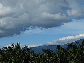
Titiwangsa Mountain Range
| Titiwangsa Mountains | |
|---|---|
| Sankalakhiri Range | |

Panorama of the Titiwangsa Mountains at the Ulu Bernam's PLUS Rest Area
|
|
| Highest point | |
| Peak | Gunung Korbu |
| Elevation | 2,183 m (7,162 ft) |
| Dimensions | |
| Length | 480 km (300 mi) NW/SE |
| Width | 120 km (75 mi) NE/SW |
| Geography | |
| Countries | Malaysia and Thailand |
| Range coordinates | 5°58′12″N 101°19′37″E / 5.9699°N 101.3269°ECoordinates: 5°58′12″N 101°19′37″E / 5.9699°N 101.3269°E |
| Parent range | Tenasserim Hills |
| Borders on | Thailand/Malaysia |
| Geology | |
| Age of rock | Permian, Triassic |
| Type of rock | Granite, limestone |
The Titiwangsa Mountains (Malay: Banjaran Titiwangsa; بنجرن تيتيوڠسا), also known as "Banjaran Besar" (Main Range) by locals, are the mountain range that forms the backbone of the Malay peninsula. The northern section of the range is in southern Thailand, where it is known as Sankalakhiri Range (Thai: ทิวเขาสันกาลาคีรี, pronounced [tʰīw kʰǎw sǎn.kāːlāːkʰīːrīː]).
The range acts as a natural divider, dividing peninsular Malaysia, as well as southernmost Thailand, into east and west coast regions. The length of mountain range is about 480 km from north to south.
The Titiwangsa Mountains are part of a suture zone that runs north-south, starting in Thailand (Nan-Uttaradit/Dien Bien Phu suture zone) and extending south towards peninsular Malaysia (Bentong-Raub suture zone). The western half of the Titiwangsa Mountains in peninsular Malaysia is an amalgamation of continental terranes known as Cimmeria or Indochina, whereas the eastern half is an amalgamation of continental terranes Sinoburmalaya or Sibumasu. These two halves of terranes were separated by the Paleo-Tethys Ocean.
The Cimmeria was separated from Gondwana around 400 mya during Devonian and rifted towards Laurasia, the northeastern arm of Pangea. It attached to Laurasia completely around 280 mya during the Late Permian.
...
Wikipedia
