Tijeras, New Mexico
| Tijeras, New Mexico | |
|---|---|
| Village | |

East Mountain Library in Tijeras
|
|
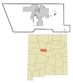
 Location of Tijeras, New Mexico |
|
| Location in the United States | |
| Coordinates: 35°5′15″N 106°22′38″W / 35.08750°N 106.37722°WCoordinates: 35°5′15″N 106°22′38″W / 35.08750°N 106.37722°W | |
| Country | United States |
| State | New Mexico |
| County | Bernalillo |
| Area | |
| • Total | 1.15 sq mi (2.99 km2) |
| • Land | 1.15 sq mi (2.97 km2) |
| • Water | 0.008 sq mi (0.02 km2) |
| Elevation | 6,322 ft (1,927 m) |
| Population (2010) | |
| • Total | 541 |
| • Estimate (2016) | 543 |
| • Density | 470/sq mi (180/km2) |
| Time zone | Mountain (MST) (UTC-7) |
| • Summer (DST) | MDT (UTC-6) |
| ZIP code | 87059 |
| Area code(s) | 505 |
| FIPS code | 35-77880 |
| GNIS feature ID | 0911709 |
| Website | villageoftijerasnm |
Tijeras is a village in Bernalillo County, New Mexico, United States. The population was 541 at the 2010 census. It is part of the Albuquerque Metropolitan Statistical Area.
Tijeras is located at 35°5′15″N 106°22′38″W / 35.08750°N 106.37722°W (35.087550, -106.377354), in central New Mexico, a few miles east of Albuquerque, on Interstate 40 (Exit 175) and U.S. Highway 66 (Route 66)/ New Mexico state highway 333. New Mexico State Road 14 leads north from the village, toward Cedar Crest, Sandia Crest, Madrid and Santa Fe. New Mexico State Road 337 leads south from Tijeras.(See Google map).
Tijeras is at the junction of Tijeras Canyon, leading to the west, toward Albuquerque, and Cedro Canyon, leading to the south, toward the Manzano Mountains.
...
Wikipedia

