Thorame-Haute
| Thorame-Haute | ||
|---|---|---|

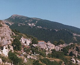
Village of Peyresc
|
||
|
||
| Coordinates: 44°05′52″N 6°33′22″E / 44.0978°N 6.5561°ECoordinates: 44°05′52″N 6°33′22″E / 44.0978°N 6.5561°E | ||
| Country | France | |
| Region | Provence-Alpes-Côte d'Azur | |
| Department | Alpes-de-Haute-Provence | |
| Arrondissement | Castellane | |
| Canton | Allos-Colmars | |
| Intercommunality | Haut Verdon-Val d'Allos | |
| Government | ||
| • Mayor (2008–2014) | Thierry Otto-Bruc | |
| Area1 | 108.35 km2 (41.83 sq mi) | |
| Population (2008)2 | 228 | |
| • Density | 2.1/km2 (5.5/sq mi) | |
| Time zone | CET (UTC+1) | |
| • Summer (DST) | CEST (UTC+2) | |
| INSEE/Postal code | 04219 /04170 | |
| Elevation | 971–2,682 m (3,186–8,799 ft) | |
|
1 French Land Register data, which excludes lakes, ponds, glaciers > 1 km² (0.386 sq mi or 247 acres) and river estuaries. 2Population without double counting: residents of multiple communes (e.g., students and military personnel) only counted once. |
||
1 French Land Register data, which excludes lakes, ponds, glaciers > 1 km² (0.386 sq mi or 247 acres) and river estuaries.
Thorame-Haute is a commune in the Alpes-de-Haute-Provence department in southeastern France.
Thorame-Haute is a village in Alpes-de-Haute-Provence, fixed on the foot of the Massif of Chamatte at an altitude of 1,150 metres (3,773 ft), in the valley of the High-Verdon. The culminating point is on the mountain of Grand-Coyer (2,693 m or 8,835 ft). The point low corresponds to the bed of the Verdon valley. The commune is more downstream from the High-Verdon. The village of Thorame is surrounded by four mountain peaks: Chamatte (2,081 m or 6,827 ft), Cheinet (1,850 m or 6,070 ft), Serpeigier (1,718 m or 5,636 ft), and Cordeil (2,114 m or 6,936 ft).
The commune is composed of several villages, among which are Colle-Saint-Michel and Peyresq, old communes having amalgamated in 1964, before being attached to Thorame in 1974. Peyresq is characterized by its exceptional site and its mountain architecture which was restored.
Another remarkable village is that of Ondres, which is not inhabited anymore in a permanent way and which refused modern comfort: running water, electricity, telephone; the access road is not paved. However a group of estivants required electrical installation recently; in their majority the inhabitants refused it. In summer the population of Ondres can exceed 100 inhabitants.
Villages: Thorame (chief town), Ondres, Colle-Saint-Michel, Peyresq. Other localities: Branchaï, Thorame-Haute-Gare, La Rivière, La Royère, Plan-de-Lys, Fontanil, Font-Gaillarde, l'Iscle, Plan-de-Verdon.
Some streets and districts of the village: The name of the streets take again the names which appear on the old land register of the middle of the 19th century, and which corresponded rather to names of districts such as: Saint-Pierre, Saint-Julien, Rastellone, Subret, Peyran. Riou constitutes a true suburb located at the North and the top of the historical center, it seems that it developed as from the seventeenth century to answer the rise of population, it took the name of the river which crosses the village. From its structure, it constitutes a village within the village with its ordered streets and its two fountains.
The chief town is located at the crossroads of the roads of valley of the Means the Verdon, D 955, of the valley of the Vaïre and the High Verdon D 908 and that which connects it to Saint-André-les-Alpes, passing by Thorame-Basse and the valley of the Issole, D 2. The train station is the only one in the High-Verdon, and the railway connects Digne to Nice. The tunnel, the longest of the line, connects the valley of the Verdon to that of the Vairy.
...
Wikipedia


