The Chevin
| The Chevin | |
|---|---|

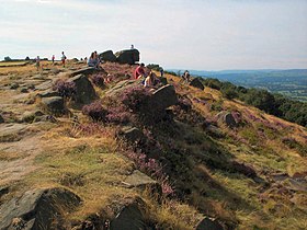
Viewpoint near the summit of Otley Chevin.
|
|
| Highest point | |
| Elevation | 282 m (925 ft) |
| Geography | |
| Location | Wharfedale, overlooking Otley, West Yorkshire, England |
| OS grid | SE204442 |
| Topo map | OS Landranger 104, OS Explorer 297 |
The Chevin is the name given to the ridge on the south side of Wharfedale in Leeds, West Yorkshire, England, overlooking the market town of Otley, and often known as Otley Chevin.
The Chevin is largely covered in attractive old woodland and heathland. It is a part of the Carboniferous Millstone Grit group. A Roman road ran along the top of the Chevin, part of the road that linked Eboracum (York), Calcaria (Tadcaster) and Olicana (Ilkley), perhaps on the same route as the modern road, Yorkgate, or perhaps about 800m to the south.
The highest point of the Chevin, Surprise View, reaches 282 metres (925 ft) at grid reference SE204442. This point offers extensive views of Otley and Wharfedale, and has an adjacent car park. It is the site of a beacon, and a cross has been erected every Easter since 1969.
The name comes from the Brythonic cefyn, cefn or cefu meaning a "ridge", or "ridge of high land". The root name informs other hills, such as Cefn Cribwr and Cefn Bryn in Glamorgan amongst many others in Wales, and also, it has been argued, The Cheviot in Northumberland, and the Cévennes in France.
...
Wikipedia
