Thaumiers
| Thaumiers | |
|---|---|
| Commune | |

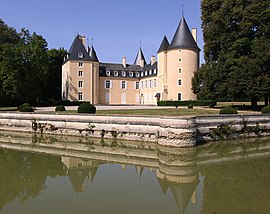
The Château of La Forêt
|
|
| Coordinates: 46°49′20″N 2°39′21″E / 46.8222°N 2.6558°ECoordinates: 46°49′20″N 2°39′21″E / 46.8222°N 2.6558°E | |
| Country | France |
| Region | Centre-Val de Loire |
| Department | Cher |
| Arrondissement | Saint-Amand-Montrond |
| Canton | Dun-sur-Auron |
| Intercommunality | CC Le Dunois |
| Government | |
| • Mayor (2008–2014) | Philippe de Bonneval |
| Area1 | 27.33 km2 (10.55 sq mi) |
| Population (2008)2 | 416 |
| • Density | 15/km2 (39/sq mi) |
| Time zone | CET (UTC+1) |
| • Summer (DST) | CEST (UTC+2) |
| INSEE/Postal code | 18261 /18210 |
| Elevation | 165–236 m (541–774 ft) (avg. 181 m or 594 ft) |
|
1 French Land Register data, which excludes lakes, ponds, glaciers > 1 km² (0.386 sq mi or 247 acres) and river estuaries. 2Population without double counting: residents of multiple communes (e.g., students and military personnel) only counted once. |
|
1 French Land Register data, which excludes lakes, ponds, glaciers > 1 km² (0.386 sq mi or 247 acres) and river estuaries.
Thaumiers is a commune in the Cher department in the Centre-Val de Loire region of France.
An area of forestry and farming comprising the village and several hamlets situated about 21 miles (34 km) southeast of Bourges at the junction of the D41 with the D92 and D943 roads. The Auron River forms the western and southern boundaryies of the commune.
...
Wikipedia


