Texas State Highway Loop 1
| State Highway Loop 1 | ||||
|---|---|---|---|---|
| MoPac Expressway | ||||
 |
||||
| Route information | ||||
| Length: | 25.698 mi (41.357 km) | |||
| Existed: | 1967 – present | |||
| Major junctions | ||||
| South end: |
|
|||
|
|
||||
| North end: |
|
|||
| Location | ||||
| Counties: | Travis, Williamson | |||
| Highway system | ||||
|
||||
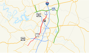
Loop 1 is a freeway which provides access to the west side of Austin in the U.S. state of Texas. It is named Mopac Expressway (or, according to some highway signs, Mopac Boulevard) after the Missouri Pacific Railroad (or "MoPac"). Local residents will invariably use the name "MoPac" rather than calling the road by its number which can cause much confusion as few signs along the road use this name.
The original section of the highway was built in the 1970s along the right-of-way of the Missouri Pacific Railroad (now owned by Union Pacific), with the railroad tracks running in the highway median between West 8th Street and Northland Drive. To the north, the tracks run along the east side of newer sections of the highway from Northland Drive to Braker Lane.
...
Wikipedia


