Terai-Duar savanna and grasslands
| Terai-Duar savanna and grasslands | |
|---|---|

Rhinoceros unicornis in Chitwan National Park, Nepal
|
|
 |
|
| Ecology | |
| Biome | Tropical and subtropical grasslands, savannas, and shrublands |
| Borders | |
| Bird species | 366 |
| Mammal species | 115 |
| Geography | |
| Area | 34,600 km2 (13,400 sq mi) |
| Countries | India, Nepal and Bhutan |
| Conservation | |
| Habitat loss | 90.62% |
| Protected | 8.91% |
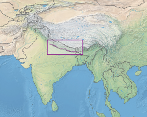
The Terai-Duar savanna and grasslands is a narrow lowland ecoregion at the base of the Himalayas, about 25 km (16 mi) wide, and a continuation of the Gangetic Plain. It is colloquially called Terai in the Ganges Basin east to Nepal, then Dooars in West Bengal, Bangladesh, Bhutan and Assam east to the Brahmaputra River. The world's tallest grasslands are found in this ecoregion, which are the most threatened and rare worldwide.
This tropical and subtropical grasslands, savannas, and shrublands biome stretches from western Bhutan to southern Nepal's Terai, westward to Banke, covering the Dang and Deukhuri Valleys along the Rapti River to India's Bhabar and Doon Valleys. Each end crosses the border into India's states of Uttar Pradesh and Bihar. The eastern and central areas are wetter than the western end.
In Nepal, the wetlands of Koshi Tappu Wildlife Reserve, Beeshazar Tal in the bufferzone of Chitwan National Park, Jagdishpur Reservoir and Ghodaghodi Tal are designated Ramsar sites. The Sukla Phanta Wildlife Reserve is Nepal's largest patch of continuous grassland.
...
Wikipedia
