Tarutao National Marine Park
| Tarutao National Park | |
|---|---|
|
IUCN category II (national park)
|
|

|
|
|
Location in Thailand
|
|
| Location | Satun Province, Thailand |
| Nearest city | Satun |
| Coordinates | 6°35′43″N 99°38′41″E / 6.59528°N 99.64472°ECoordinates: 6°35′43″N 99°38′41″E / 6.59528°N 99.64472°E |
| Area | 1,490 km² |
| Established | 19 April 1974 |
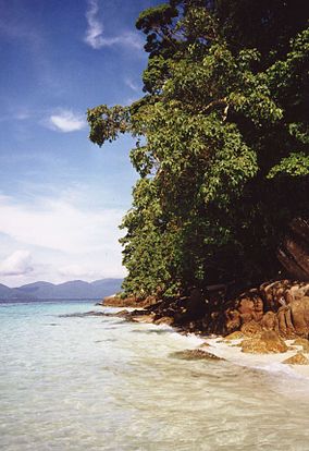
Tarutao National Park (Thai: อุทยานแห่งชาติตะรุเตา) consists of 51 islands in the Strait of Malacca, off the coast of Satun Province of southern Thailand. The Tarutao National Park consists of two island groups: Tarutao (Thai: หมู่เกาะตะรุเตา, Thai pronunciation: [mùː kɔ̀ʔ tàʔ.rúʔ.taw] or [ta.ru.taw]) and Adang-Rawi (Thai: หมู่เกาะอาดัง-ราวี, Thai pronunciation: [mùː kɔ̀ʔ ʔaːdaŋ raːwiː]), which are scattered from 20 to 70 kilometres distance from the south-westernmost point of mainland Thailand. The park covers an area of 1,490 square kilometres (1,260 ocean, 230 island). The southernmost end of the park lies on the border with Malaysia. Tarutao became Thailand's second marine national park on 19 April 1974. The coastal Khao Sam Roi Yot National Park had been designated in 1966.
The name "tarutao" is a Thai corruption of its original Malay name, "pulau tertua", "old, mysterious, and primitive island."
Ko Tarutao was the setting for Survivor: Thailand, the 2002 season for the reality television series, Survivor. The Philippine version of the series was also set there six years later.
...
Wikipedia

