Tarare
| Tarare | ||
|---|---|---|

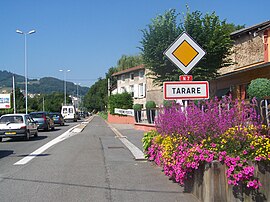
The road into Tarare
|
||
|
||
| Coordinates: 45°53′49″N 4°26′02″E / 45.8969°N 4.4339°ECoordinates: 45°53′49″N 4°26′02″E / 45.8969°N 4.4339°E | ||
| Country | France | |
| Region | Auvergne-Rhône-Alpes | |
| Department | Rhône | |
| Arrondissement | Villefranche-sur-Saône | |
| Canton |
Tarare (chef-lieu) |
|
| Intercommunality | Pays de Tarare | |
| Government | ||
| • Mayor (2014-2020) | Bruno Peylachon | |
| Area1 | 13.99 km2 (5.40 sq mi) | |
| Population (2012)2 | 10,401 | |
| • Density | 740/km2 (1,900/sq mi) | |
| Time zone | CET (UTC+1) | |
| • Summer (DST) | CEST (UTC+2) | |
| INSEE/Postal code | 243 69 243 /69 170 | |
| Elevation | 350–727 m (1,148–2,385 ft) (avg. 359 m or 1,178 ft) |
|
|
1 French Land Register data, which excludes lakes, ponds, glaciers > 1 km² (0.386 sq mi or 247 acres) and river estuaries. 2Population without double counting: residents of multiple communes (e.g., students and military personnel) only counted once. |
||
1 French Land Register data, which excludes lakes, ponds, glaciers > 1 km² (0.386 sq mi or 247 acres) and river estuaries.
Tarare is a commune in the Rhône department in eastern France.
It lies on the Turdine river, 28 miles west-northwest of Lyon by rail.
Pop. (1906) 11,643.
According to the 1911 Encyclopædia Britannica Eleventh Edition:
...
Wikipedia


