Tappan Zee
| Tappan Zee | |
| Estuary | |
|
Northern Tappan Zee
|
|
| Name origin: Tuphanne, Lenape term thought to mean "cold water". Zee, Dutch for Sea. | |
| Country | United States |
|---|---|
| State | New York |
| Tributaries | |
| - left | Croton River, Pocantico River |
| - right | Sparkill Creek |
| Source | Hudson River, by way of Haverstraw Bay |
| - location | Croton-on-Hudson, New York |
| - elevation | 0 ft (0 m) |
| - coordinates | 41°10′03.64″N 73°53′54.65″W / 41.1676778°N 73.8985139°W |
| Mouth | North River (Lower Hudson) |
| - location | Dobbs Ferry, New York |
| - elevation | 0 ft (0 m) |
| - coordinates | 41°00′47.20″N 73°53′28.81″W / 41.0131111°N 73.8913361°WCoordinates: 41°00′47.20″N 73°53′28.81″W / 41.0131111°N 73.8913361°W |
| Length | 10.5 mi (17 km), North-South |
| Width | 3 mi (5 km), East-West |
| Depth | 52 ft (16 m) |
| NOAA Nav Chart | 12343 |
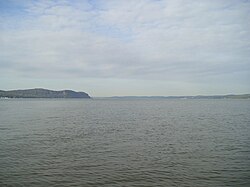
The Tappan Zee (/ˌtæpən ˈziː/; also Tappan Sea or Tappaan Zee) is a natural widening of the Hudson River, about 3 mi (5 km) across at its widest, in southeastern New York in the United States. It stretches about 10 mi (16 km) along the boundary between Rockland and Westchester counties, downstream from Croton Point to Irvington. It derives its name from the Tappan Native American sub-tribe of the Delaware/Lenni Lenape, and the Dutch word zee, meaning a sea.
Flanked to the west by high steep bluffs of the New Jersey Palisades in the Hudson Valley, it forms something of a natural lake on the Hudson about 10 mi (16 km) north of Manhattan. Communities along the Tappan Zee include Nyack on the western side as well as Ossining and Tarrytown on the eastern side. It is crossed by the Tappan Zee Bridge, opened in 1955 and about 3.1 mi (5 km) long, connecting Nyack and Tarrytown.
...
Wikipedia

