Taplow
| Taplow | |
|---|---|
 The mock-medieval parish church built in 1911. |
|
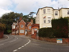
 Berry Hill, part of the developed traditional core |
|
| Taplow shown within Buckinghamshire | |
| Area | 11.22 km2 (4.33 sq mi) |
| Population | 1,669 (2011 census) |
| • Density | 149/km2 (390/sq mi) |
| OS grid reference | SU9182 |
| Civil parish |
|
| District | |
| Shire county | |
| Region | |
| Country | England |
| Sovereign state | United Kingdom |
| Post town | MAIDENHEAD |
| Postcode district | SL6 |
| Dialling code | 01628 |
| Police | Thames Valley |
| Fire | Buckinghamshire |
| Ambulance | South Central |
| EU Parliament | South East England |
| UK Parliament | |
Taplow is a village and civil parish in the South Bucks district of Buckinghamshire, England. It sits on the left bank of the River Thames, facing Maidenhead in the neighbouring county of Berkshire, and is roughly 1 mile (1.6 km) west of Burnham and 25 miles (40 km) west of Charing Cross in London.
Taplow railway station is near the A4 south of the settled part of the village and provides access to and from Oxford, Reading and London Paddington.
There are two conservation areas in the parish: the Taplow Village Conservation Area and the Taplow Riverside Conservation Area.
Footpaths connect all parts of the parish to Maidenhead Bridge and to Burnham Beeches, a modest, hilly wood marking the start of the Chiltern Hills.
The village has a geological Site of Special Scientific Interest, South Lodge Pit, dating to the late Cretaceous.
The village's name is Anglo Saxon in origin, and means Tæppa's barrow; the Anglo-Saxon burial mound of Tæppa can still be visited, and important artefacts excavated there are now in the British Museum, notably a gold belt buckle. Taplow was recorded in the Domesday Book of 1086 as Thapeslau. Taplow Court nearby is also the site of an early Iron Age hill fort and was the site of the manor house.
...
Wikipedia

