Tallard
| Tallard | ||
|---|---|---|
| Commune | ||

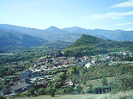
The village of Tallard
|
||
|
||
| Coordinates: 44°27′45″N 6°03′19″E / 44.4625°N 6.0553°ECoordinates: 44°27′45″N 6°03′19″E / 44.4625°N 6.0553°E | ||
| Country | France | |
| Region | Provence-Alpes-Côte d'Azur | |
| Department | Hautes-Alpes | |
| Arrondissement | Gap | |
| Canton | Tallard | |
| Intercommunality | Tallard–Barcillonnette | |
| Government | ||
| • Mayor (2008–2014) | Jean-Michel Arnaud | |
| Area1 | 15.02 km2 (5.80 sq mi) | |
| Population (2008)2 | 1,909 | |
| • Density | 130/km2 (330/sq mi) | |
| Time zone | CET (UTC+1) | |
| • Summer (DST) | CEST (UTC+2) | |
| INSEE/Postal code | 05170 /05130 | |
| Elevation | 570–1,121 m (1,870–3,678 ft) (avg. 604 m or 1,982 ft) |
|
|
1 French Land Register data, which excludes lakes, ponds, glaciers > 1 km² (0.386 sq mi or 247 acres) and river estuaries. 2Population without double counting: residents of multiple communes (e.g., students and military personnel) only counted once. |
||
1 French Land Register data, which excludes lakes, ponds, glaciers > 1 km² (0.386 sq mi or 247 acres) and river estuaries.
Tallard is a commune in the Hautes-Alpes department in the Provence-Alpes-Côte d'Azur region in southeastern France.
Tallard is 20 km (12 mi) to the south of Gap and on the road from Gap to Marseille. The motorway A51 ends just to the south of the village at La Saulce. The village is 21 km (13 mi) away from La Bâtie-Vieille and is also home to the Internationally renowned Gap-Tallard Aerodrome, home of CERPS Skydiving Club and French military parachute training.
From 2001 to 2008 - Jean-Michel Arnaud. Arnaud is a member of the Union for French Democracy (UDF) party, Chair of the Association of Hautes-Alpes Mayors, a member of the National Office of the Association of French Mayors, a member of the national office of UDF and farmer. He was a Tallard councillor from 1998 with responsibility for roads and the airport.
Inhabitants are called Tallardiens.
In 2007, Tallard was the start for the 229.5 km (142.6 mi) stage 10 of the Tour de France to Marseille.
...
Wikipedia


