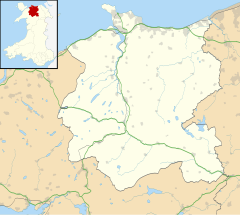
Tal-y-bont, Conwy
| Tal-y-Bont | |
|---|---|
 Tal-y-Bont |
|
| Tal-y-Bont shown within Conwy | |
| OS grid reference | SH766688 |
| Community | |
| Principal area | |
| Country | Wales |
| Sovereign state | United Kingdom |
| Post town | CONWY |
| Postcode district | LL32 |
| Dialling code | 01492 |
| Police | North Wales |
| Fire | North Wales |
| Ambulance | Welsh |
| EU Parliament | Wales |
| UK Parliament | |
| Welsh Assembly | |
Tal-y-Bont is a small village in Conwy County Borough, Wales and lies in the Conwy Valley, west of the River Conwy, on the B5106 road, six miles from the town of Conwy to the north, and six miles from Llanrwst to the south. It lies adjacent to the village of Dolgarrog to the south, and below the small settlement of Llanbedr-y-Cennin to the west.
The 'Bont' (the mutated form of pont, Welsh for "bridge") in the name probably refers to the bridge over the Afon Dulyn, a tributary of the nearby River Conwy, which runs through the village.
The village is served by buses and the nearby Dolgarrog railway station.
Castell, the oldest section of Tal-y-Bont, has a bar/restaurant and also a 5-acre garden centre.
Tal-y-Bont is the starting point for the road to Llyn Eigiau and the southern Carneddau mountains. Access to the northern end of the Carneddau Range and the Roman road over to Aberystwyth can also be achieved by following the road up from Tal-y-Bont through Llanbedr-y-Cennin - which is on the eastern edge of the Snowdonia National Park - and taking a left fork at the pub, Ye Olde Bull Inn, in Llanbedr.
Walkers can access peaks in the northern end of the Carneddau Range such as Drum and Foel Fras, and then continue south east to reach Carnedd Llewelyn.
To the west is a hill named Pen-y-Gaer, on top of which can be found remains of a Bronze Age hillfort. The hill occupies a commanding position above the village, with views north down the valley to the town of Conwy and Llandudno, and south to Llanrwst. Pen-y-Gaer can be reached by following the road that runs up through Llanbedr-y-Cennin, taking the left fork at the Olde Bull Inn and then taking a left several miles later when the hill appears directly above to your left.
...
Wikipedia

