Szarvas
| Szarvas | ||
|---|---|---|

Old Lutheran church (1786-1788)
|
||
|
||
| Coordinates: 46°51′50″N 20°33′25″E / 46.864°N 20.557°E | ||
| Country |
|
|
| County | Békés | |
| Area | ||
| • Total | 161.57 km2 (62.38 sq mi) | |
| Population (2011) | ||
| • Total | 16,954 | |
| • Density | 114.35/km2 (296.2/sq mi) | |
| Time zone | CET (UTC+1) | |
| • Summer (DST) | CEST (UTC+2) | |
| Postal code | 5540 | |
| Area code(s) | 66 | |
Szarvas (German: Sarwasch, Slovak: Sarvaš; IPA: [sarvaʃ]) is a town in Békés County, Hungary.
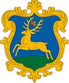
Placename Szarvas originated from the old Hungarian word szarvas, which means deer. Deer also can be found in the coat of arms of the town.
Szarvas is located in the Great Hungarian Plain upon the Körös River, 170 km (106 mi) southeast from Budapest. Highways 44 and 443, and the Mezőtúr-Orosháza-Mezőhegyes railway line also cross the town. The geographic centre of Hungary was near Szarvas before the Treaty of Trianon; a memorial in a windmill shape now marks that location in a park on a bank of the Körös River across from the Arboretum.
According to the Hungarian Royal Treasury (Hungarian: Magyar Királyi Kincstár) it was an ethnic Hungarian town in 1495. The Medieval town was ruined due to the Ottoman wars, native Hungarian population fled from the area. It was uninhabited until 1720, when Austrian baron Johann Georg Freiherr von Harruckern (György János Harruckern) invited mainly Slovak settlers from Upper Hungary to the deserted area. They built a brand new town by the help of Sámuel Tessedik, who invited engenners to planning the town. Tessedik also established the first agricultural school in Hungary. Lutheran church was built from 1786 to 1788, the Roman Catholic from 1808 to 1812. Town hall was built in 1820. Hungarians overtook Slovaks in the 1920s, become the majority according to the census was held in 1930.
...
Wikipedia


