Swan's Landing Archeological Site
|
Swan's Landing Archeological Site (12HR304)
|
|

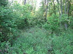
Woods at the site
|
|
| Location | Mile 658 on the Ohio River |
|---|---|
| Nearest city | New Amsterdam, Indiana |
| Coordinates | 38°7′54.5″N 86°16′8″W / 38.131806°N 86.26889°WCoordinates: 38°7′54.5″N 86°16′8″W / 38.131806°N 86.26889°W |
| Area | 1.4 acres (0.57 ha) |
| NRHP Reference # | 87000517 |
| Added to NRHP | April 2, 1987 |
The Swan's Landing Archeological Site is an archaeological site from the Early Archaic period in Harrison County, Indiana, United States. Located along the Ohio River, it has been extensively damaged by modern activity, but it is still one of the most important sites for its time period in North America. It has been designated a historic site because of its archaeological value.
Located along the Ohio River, the site is largely buried by as much as 6 metres (20 ft) of alluvium deposited by the river. It sits at Mile 658 in the river's floodplain, about 3.5 kilometres (2.2 mi) north of the town of New Amsterdam, and about 6 kilometres (3.7 mi) above the confluence of the Blue River. Measuring about 5 hectares (12 acres) in area, its name is taken from the area's former use by the Swan family as a landing for riverboats along the Ohio. Nearby terrain features include a dirt road at the site's southern end, a large pond just a stone's throw to the south, and the mouth of Indian Creek about 1,800 metres (5,900 ft) south of the site.
Local residents became aware of the site by the early 1960s, at which time collectors were finding projectile points on the beach; however, it was first published in 1982. Between these years, the site was greatly damaged by human activity: some intentionally, and some unintentionally. Realizing that large numbers of artifacts were buried under the soil, some individuals began to dig with shovels on the side of the alluvial deposits, while others brought high-pressure hoses to wash away the top of the deposits. By the time that professional archaeologists discovered the site in the early 1980s, extensive vandalism had removed large amounts of soil and large numbers of artifacts. Moreover, changes in 1974 to the management of the Cannelton Locks and Dam, downstream from the site, caused the water level to rise, eroding the riverbank rapidly. By the mid-1990s, the riverbank had eroded more than 20 metres (66 ft) from its previous location.
...
Wikipedia


