Sunnyside (Surrey)
| Sunnyside | |
|---|---|
| Neighbourhood | |
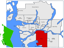
 Location of Surrey in Metro Vancouver |
|
| Country |
|
| Province |
|
| Region | Lower Mainland |
| Regional District | Metro Vancouver |
| City | Surrey, British Columbia |
| Government | |
| • Mayor | Linda Hepner of Surrey |
| • MP (Fed.) | Dianne Watts |
| • MLA (B.C.) | Gordon Hogg |
| Time zone | PST (UTC-8) |
Sunnyside is a neighbourhood of South Surrey, which in turn is a region of Surrey, British Columbia, Canada.
There is no historical significance to the name, other than that its location is on the sunnier, south slope of the "uplands" of Surrey, on the Semiahmoo peninsula.
As traders, the original Coast Salish peoples since the last Ice Age established communities at the mouths of the local rivers, the Nicomekl, Serpentine, and Campbell Rivers, which connected them to inland communities.
As the forebears of the present Semiahmoo First Nation faced raids from northern First Nations' groups, they used what came to be known as the Sunnyside area as access to a fort built in the 1830s on what is now the Ocean Park bluffs.
The Semiahmoo also used a route across the Sunnyside area of South Surrey to cross the ridge between the Campbell River to the south and Mud Bay to the north, where the Nicomekl and Serpentine were. By 1890 this was called the Semiahmoo Trail.
The Telegraph Trail was built along this route in 1865 meant as part of a telegraph linkage from the mainland-USA through Alaska and Siberia to Europe. Initially it was known as The Collins Overland Trail, and the first message carried on it to New Westminster was to report the assassination of Abraham Lincoln in April 1865. The line reached New Westminster from the USA in June 1865. It also provided access from the Nicomekl River a few miles north, to the Boundary Commission Camp located at the mouth of the Little Campbell River at the Canada–United States border. The Boundary Commission Camp had been established in 1858.
The Semiahmoo Wagon Road was built in 1872-4 to connect the Fraser River to the north with Blaine, Washington, to the south. In 1878, stage service on the Semiahmoo Trail increased to twice weekly, between Brown’s Landing and the border to the south. In 1882 the Canadian Customs Department established the first near-border facility, an “out-port” customs office at Elgin north of the Sunnyside area. This was located where the Semiahmoo Trail met the Nicomekl River and operated until 1891. When the railway was relocated to Hazelmere to the east of Sunnyside, the land crossing at Douglas, B.C./Blaine, Washington, became the main customs area.
Led by then Alderman Garry Watkins, in 1977 the (then) District of Surrey proclaimed it a Designated Heritage site. South of 24th Avenue, the present trail deviates slightly from the original route, but on 148 Street there is a specially constructed "Semiahmoo Trail" pedestrian overpass keeping the trail intact.
...
Wikipedia
