Sundarbans Reserve Forest
| The Sundarbans | |
|---|---|
| সুন্দরবন | |

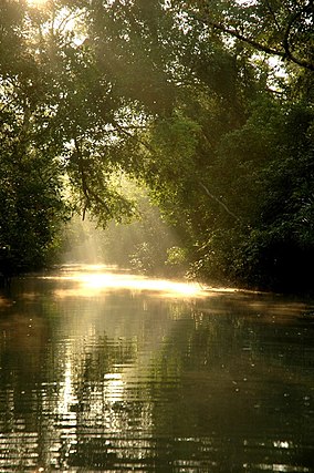
Sun in the Sundarbans
|
|
|
Location in Bangladesh
|
|
| Location | Khulna Division, Bangladesh |
| Nearest city | Khulna, Satkhira, Bagerhat |
| Coordinates | 21°57′N 89°11′E / 21.950°N 89.183°ECoordinates: 21°57′N 89°11′E / 21.950°N 89.183°E |
| Area | 139,500 ha (539 sq mi) |
| Established | 1991 |
| Governing body | Government of Bangladesh |
| Type | Natural |
| Criteria | ix, x |
| Designated | 1997 (21st session) |
| Reference no. | 798 |
| State Party |
|
| Region | Asia-Pacific |
| Official name | Sundarbans Reserved Forest |
| Designated | 21 May 1992 |
The Sundarbans (Bengali: সুন্দরবন, Shundôrbôn) is a natural region in southern Bangladesh and extreme southern part of the Indian state of West Bengal in the vast river delta on the Bay of Bengal. It is the largest single block of tidal halophytic mangrove forest in the world. The Sundarbans covers approximately 10,000 square kilometres (3,900 sq mi) most of which is in Bangladesh with the remainder in India. The Sundarbans is a UNESCO World Heritage Site.
Sundarbans South, East and West are three protected forests in Bangladesh. This region is densely covered by mangrove forests, and is the largest reserves for the Bengal tiger. The Sundarbans National Park is a National Park, Tiger Reserve, and a Biosphere Reserve located in the Sundarbans delta in the Indian state of West Bengal.
The name Sundarban can be literally translated as "beautiful forest" in the Bengali language (Shundôr, "beautiful" and bôn, "forest"). The name may have been derived from the Sundari trees (the mangrove species Heritiera fomes) that are found in Sundarbans in large numbers. Alternatively, it has been proposed that the name is a corruption of Samudraban, Shomudrobôn ("Sea Forest"), or Chandra-bandhe (name of a primitive tribe). However, the generally accepted view is the one associated with Sundari or Sundri trees.
...
Wikipedia

