Summerside, Ohio
| Summerside, Ohio | |
|---|---|
| Census-designated place | |
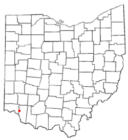
 Location of Summerside, Ohio |
|
| Coordinates: 39°7′2″N 84°17′27″W / 39.11722°N 84.29083°WCoordinates: 39°7′2″N 84°17′27″W / 39.11722°N 84.29083°W | |
| Country | United States |
| State | Ohio |
| County | Clermont |
| Township | Union |
| Area | |
| • Total | 2.09 sq mi (5.42 km2) |
| • Land | 2.08 sq mi (5.40 km2) |
| • Water | 0.008 sq mi (0.02 km2) |
| Elevation | 879 ft (268 m) |
| Population (2010) | |
| • Total | 5,083 |
| • Density | 2,436/sq mi (940.5/km2) |
| Time zone | Eastern (EST) (UTC-5) |
| • Summer (DST) | EDT (UTC-4) |
| FIPS code | 39-75434 |
| GNIS feature ID | 1049226 |
Summerside is a census-designated place (CDP) in Union Township, Clermont County, Ohio, United States. The population was 5,083 at the 2010 census.
Originally known as "East Mount Carmel", the name of the community was changed around the time a post office was established in August 1887.
Summerside is located in western Clermont County at 39°7′2″N 84°17′27″W / 39.11722°N 84.29083°W (39.117261, -84.290728), in the western part of Union Township. It is bordered to the south by Mount Carmel. Ohio State Route 32 forms part of the southern boundary of the CDP, and Interstate 275 forms the eastern boundary, with access to Summerside from Exit 63, where it intersects Route 32. Downtown Cincinnati is 16 miles (26 km) to the west via Route 32 and U.S. Route 50.
According to the United States Census Bureau, the CDP has a total area of 2.1 square miles (5.4 km2), of which 0.008 square miles (0.02 km2), or 0.32%, is water.
As of the census of 2000, there were 5,523 people, 2,195 households, and 1,536 families residing in the CDP. The population density was 2,425.2 people per square mile (935.3/km²). There were 2,277 housing units at an average density of 999.9/sq mi (385.6/km²). The racial makeup of the CDP was 96.13% White, 1.14% African American, 0.25% Native American, 1.01% Asian, 0.45% from other races, and 1.01% from two or more races. Hispanic or Latino of any race were 1.10% of the population.
...
Wikipedia
