Sulphur Springs, Benton County, Arkansas
| Sulphur Springs, Arkansas | |
|---|---|
| City | |
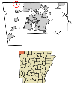
 Location of Sulphur Springs in Benton County, Arkansas. |
|
| Coordinates: 36°29′01″N 94°27′33″W / 36.48361°N 94.45917°WCoordinates: 36°29′01″N 94°27′33″W / 36.48361°N 94.45917°W | |
| Country | United States |
| State | Arkansas |
| County | Benton |
| Area | |
| • Total | 1.02 sq mi (2.65 km2) |
| • Land | 1.02 sq mi (2.64 km2) |
| • Water | 0.00 sq mi (0.01 km2) |
| Elevation | 909 ft (277 m) |
| Population (2010) | |
| • Total | 511 |
| • Estimate (2016) | 531 |
| • Density | 521.10/sq mi (201.19/km2) |
| Time zone | Central (CST) (UTC-6) |
| • Summer (DST) | CDT (UTC-5) |
| ZIP code | 72768 |
| Area code(s) | 479 |
| FIPS code | 05-67760 |
| GNIS feature ID | 2405541 |
Sulphur Springs is a city in Benton County, Arkansas, United States. The population was 511 at the 2010 census. It is part of the Fayetteville–Springdale–Rogers, AR-MO Metropolitan Statistical Area.
Sulphur Springs had its start in 1885 as a mineral spa resort.
Sulphur Springs is located in northwest Benton County at 36°29′01″N 94°27′33″W / 36.48361°N 94.45917°W (36.4835487 -94.4591194). The city center is about one mile south of the Missouri-Arkansas state line. Arkansas Highway 59 runs through the city, leading north to Noel, Missouri, and south to Gravette.
According to the United States Census Bureau, the city has a total area of 1.0 square mile (2.6 km2), all of it land.
At the 2000 census, there were 671 people, 229 households and 160 families residing in the city. The population density was 667.1 per square mile (256.5/km²). There were 279 housing units at an average density of 277.4 per square mile (106.7/km²). The racial makeup of the city was 86.74% White, 2.24% Black or African American, 0.89% Native American, 0.30% Asian, 7.15% from other races, and 2.68% from two or more races. Hispanic or Latino of any race were 16.69% of the population.
...
Wikipedia
