Fayetteville, Arkansas
| Fayetteville, Arkansas | ||
|---|---|---|
| City | ||
| City of Fayetteville | ||

Clockwise from top: Fayetteville skyline around the Historic Square, Donald W. Reynolds Razorback Stadium, Old Main, Wilson Park, the Fayetteville Depot, and the Washington County Courthouse.
|
||
|
||
| Nickname(s): "Track Capital of the World", "The Hill", "Athens of the Ozarks" | ||
| Motto: Regnat Populus (the people rule) | ||
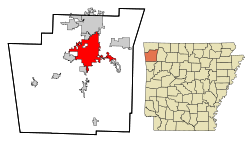
 Location in Washington County and the state of Arkansas |
||
| Location within the contiguous United States of America | ||
| Coordinates: 36°4′35″N 94°9′39″W / 36.07639°N 94.16083°WCoordinates: 36°4′35″N 94°9′39″W / 36.07639°N 94.16083°W | ||
| Country |
|
|
| State |
|
|
| County | Washington | |
| Township | Fayetteville | |
| Founded | 1828 | |
| Incorporated | 1836 | |
| Rechartered | 1867 | |
| Named for | originally George Washington, renamed after Fayetteville, Tennessee | |
| Government | ||
| • Type | Mayor-council | |
| • Mayor | Lioneld Jordan | |
| • City Council |
Aldermen
|
|
| Area | ||
| • City | 143 km2 (55.2 sq mi) | |
| • Land | 139 km2 (53.8 sq mi) | |
| • Water | 4 km2 (1.4 sq mi) | |
| Elevation | 427 m (1,400 ft) | |
| Population (2010) | ||
| • City | 73,580 | |
| • Estimate (2015) | 82,830 | |
| • Density | 527.5/km2 (1,366.3/sq mi) | |
| • Urban | 295,083 (US: 129th) | |
| • Metro | 491,966 (US: 106th) | |
| Time zone | Central (UTC-6) | |
| • Summer (DST) | Central (UTC-5) | |
| ZIP codes | 72701–72704 | |
| Area code(s) | 479 | |
| FIPS code | 05-23290 | |
| GNIS feature ID | 0076914 | |
| Major airport | XNA | |
| Website | City of Fayetteville | |
| U.S. Geological Survey Geographic Names Information System: Fayetteville, Arkansas | ||
| Fayetteville Experimental Station | ||||||||||||||||||||||||||||||||||||||||||||||||||||||||||||
|---|---|---|---|---|---|---|---|---|---|---|---|---|---|---|---|---|---|---|---|---|---|---|---|---|---|---|---|---|---|---|---|---|---|---|---|---|---|---|---|---|---|---|---|---|---|---|---|---|---|---|---|---|---|---|---|---|---|---|---|---|
| Climate chart () | ||||||||||||||||||||||||||||||||||||||||||||||||||||||||||||
|
||||||||||||||||||||||||||||||||||||||||||||||||||||||||||||
|
||||||||||||||||||||||||||||||||||||||||||||||||||||||||||||
| J | F | M | A | M | J | J | A | S | O | N | D |
|
2
46
26
|
2.4
50
29
|
3.5
59
38
|
4.1
69
47
|
5
76
56
|
4.6
84
64
|
3.2
89
69
|
2.8
89
68
|
4.4
81
59
|
3.8
70
48
|
4.2
59
39
|
2.7
48
28
|
| Average max. and min. temperatures in °F | |||||||||||
| Precipitation totals in inches | |||||||||||
| Metric conversion | |||||||||||
|---|---|---|---|---|---|---|---|---|---|---|---|
| J | F | M | A | M | J | J | A | S | O | N | D |
|
51
8
−3
|
Wikipedia
...
| ||||||||||


