Suheli Par
| Geography | |
|---|---|
| Location | Arabian Sea |
| Coordinates | 10°04′N 72°18′E / 10.07°N 72.3°ECoordinates: 10°04′N 72°18′E / 10.07°N 72.3°E |
| Archipelago | Lakshadweep |
| Adjacent bodies of water | Indian Ocean |
| Total islands | 3 |
| Major islands |
|
| Area | 0.888 km2 (0.343 sq mi) |
| Highest elevation | 1 m (3 ft) |
| Administration | |
| Territory | Union territory of Lakshadweep |
| District | Lakshadweep |
| Island group | Laccadive Islands |
| Tehsils of India | Kavaratti |
| Subdivisions of India | Kavaratti |
| Demographics | |
| Demonym | Malayali |
| Population | 10 (2014) |
| Pop. density | 11 /km2 (28 /sq mi) |
| Ethnic groups | Malayali, Mahls |
| Additional information | |
| Time zone | |
| PIN | 682555, 682559, 682557 |
| Telephone code | 04890, 04895 ,04896 |
| Official website | www |
| ISO Code | IN-LD-07 |
| Literacy | 84.4% |
| Avg. summer temperature | 32.0 °C (89.6 °F) |
| Avg. winter temperature | 28.0 °C (82.4 °F) |
| Sex ratio | ♂/♀ |
| unit_pref | Metric |
Suheli Par is a coral atoll in the Union Territory of Lakshadweep, India. It is an oval-shaped 17 km long atoll surrounded by a zone of rich marine fauna.
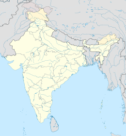
Suheli Par is located at 10°05′N 72°17′E / 10.083°N 72.283°E, 52 km to the SW of Kavaratti, 76 km to the south of Agatti, 139 km to the west of Kalpeni and 205 km to the NNW of Minicoy, with the broad Nine Degree Channel between them. The Lagoon area is 87.76 km2 (33.88 sq mi).
There are three islands on the reef encircling the lagoon.
It has a size of 0.395 square kilometres (0.153 square miles).
Its size is 0.11 square kilometres (0.042 square miles).
Both islands have coconut trees, as well as Pandanus, Scaevola taccada, Tournefortia argentea and Pemphis acidula bushes. The grey heron and the black-capped kingfisher have been observed in this atoll. Owing to the rich marine life there was a proposal to declare Suheli Par a marine national park.
In 2006 a ship from Seychelles ran aground on this atoll, but there was no oil spill reported.
...
Wikipedia

