Sturtevant, Wisconsin
| Sturtevant, Wisconsin | |
|---|---|
| Village | |
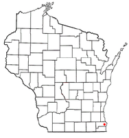
 Location of Sturtevant, Wisconsin |
|
| Coordinates: 42°41′56″N 87°53′57″W / 42.69889°N 87.89917°WCoordinates: 42°41′56″N 87°53′57″W / 42.69889°N 87.89917°W | |
| Country | United States |
| State | Wisconsin |
| County | Racine |
| Area | |
| • Total | 4.19 sq mi (10.85 km2) |
| • Land | 4.19 sq mi (10.85 km2) |
| • Water | 0 sq mi (0 km2) |
| Elevation | 702 ft (214 m) |
| Population (2010) | |
| • Total | 6,970 |
| • Estimate (2012) | 6,974 |
| • Density | 1,663.5/sq mi (642.3/km2) |
| Time zone | Central (CST) (UTC-6) |
| • Summer (DST) | CDT (UTC-5) |
| Area code(s) | 262 |
| FIPS code | 55-77925 |
| GNIS feature ID | 1575001 |
Sturtevant is a village in Racine County, Wisconsin, United States. The population was 6,970 at the 2010 census.
Sturtevant was originally known as Parkersville, after the Parker family, early settlers in the area. Other former names for Sturtevant are Western Union Junction and Corliss. The name Corliss referred to the Brown Corliss Engine Company of Milwaukee. The name Sturtevant was selected in 1923, when the B. F. Sturtevant company relocated to the village from Massachusetts.
Sturtevant is located at 42°41′56″N 87°53′57″W / 42.69889°N 87.89917°W (42.698819, -87.899202).
According to the United States Census Bureau, the village has a total area of 4.19 square miles (10.85 km2), all of it land.
As of the census of 2010, there were 6,970 people, 2,103 households, and 1,373 families residing in the village. The population density was 1,663.5 inhabitants per square mile (642.3/km2). There were 2,240 housing units at an average density of 534.6 per square mile (206.4/km2). The racial makeup of the village was 78.8% White, 15.9% African American, 0.7% Native American, 1.0% Asian, 1.3% from other races, and 2.2% from two or more races. Hispanic or Latino of any race were 6.1% of the population.
...
Wikipedia
