Racine County, Wisconsin
| Racine County, Wisconsin | |
|---|---|

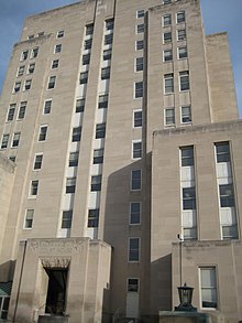
Racine County Court House
|
|
 Location in the U.S. state of Wisconsin |
|
 Wisconsin's location in the U.S. |
|
| Founded | December 7, 1836 |
| Seat | Racine |
| Largest city | Racine |
| Area | |
| • Total | 792 sq mi (2,051 km2) |
| • Land | 333 sq mi (862 km2) |
| • Water | 460 sq mi (1,191 km2), 58% |
| Population (est.) | |
| • (2014) | 195,163 |
| • Density | 586/sq mi (226/km²) |
| Congressional district | 1st |
| Time zone | Central: UTC-6/-5 |
| Website | www |
Racine County is a county located in southeastern Wisconsin. As of the 2010 census, its population was 195,408, making it the fifth-most populous county in Wisconsin. Its county seat is Racine. The county was founded in 1836, then a part of the Wisconsin Territory.
Racine County comprises the Racine metropolitan statistical area. It is included in the Milwaukee metropolitan area (Milwaukee-Racine-Waukesha).
According to the U.S. Census Bureau, the county has a total area of 792 square miles (2,050 km2), of which 333 square miles (860 km2) is land and 460 square miles (1,200 km2) (58%) is water.
The county's unemployment rate was 6.7% in August 2016.
As of the census of 2000, there were 188,831 people, 70,819 households, and 49,856 families residing in the county. The population density was 567 people per square mile (219/km²). There were 74,718 housing units at an average density of 224 per square mile (87/km²). The racial makeup of the county was 83.04% White, 10.47% Black or African American, 0.36% Native American, 0.72% Asian, 0.04% Pacific Islander, 3.69% from other races, and 1.67% from two or more races. 7.94% of the population were Hispanic or Latino of any race. 32.9% were of German, 7.4% Polish and 5.5% Irish ancestry.
...
Wikipedia
