Stroubles Creek
| Stroubles Creek | |
|---|---|

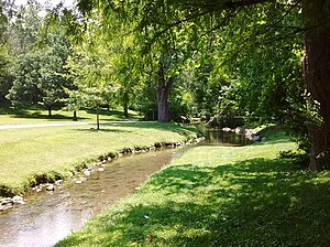
Stroubles Creek just upstream of the Virginia Tech Duck Pond
|
|
| Country | United States |
| City | Blacksburg, Virginia |
| Basin features | |
| River mouth |
New River 1,700 feet (520 m) 37°11′25″N 80°31′39″W / 37.1903°N 80.5275°WCoordinates: 37°11′25″N 80°31′39″W / 37.1903°N 80.5275°W |
| Basin size | 22.4 square miles (58 km2) |
| Landmarks | Virginia Tech |
| Tributaries |
|
| Waterbodies | Virginia Tech Duck Pond |
| Physical characteristics | |
| Length | 12 miles (19 km) |
Stroubles Creek is an approximately 12-mile-long (19 km) stream that runs through the town of Blacksburg, the Virginia Tech campus, and Montgomery County, Virginia until it empties into the New River. Most of the sections of Stroubles Creek that flow through Blacksburg and the Virginia Tech campus are piped underground, while the portion that flows through Montgomery County is above-ground. Stroubles Creek has been designated an impaired waterway since 2002.
Stroubles Creek flows into the New River, which then flows into the Kanawha River, the Ohio River, the Mississippi River, and finally the Gulf of Mexico. There are two branches that merge at the Virginia Tech Duck Pond: the Main Branch and the Webb Branch. Downstream of the Duck Pond, many tributary streams flow into Stroubles Creek, including Slate Branch and Walls Branch.
The Stroubles Creek watershed, a subwatershed of the New River watershed, is 22.4 square miles (58 km2). The Stroubles Creek watershed is further divided into an upper and a lower watershed, with the Virginia Tech Duck Pond acting as a divider between the two. The Upper Stroubles Creek watershed is approximately 3 square miles (7.8 km2), and it is heavily impacted by urbanization in Blacksburg and on the Virginia Tech campus. The Lower Stroubles Creek watershed includes some urbanized areas on the western side of the Virginia Tech campus, but then it flows mostly through rural lands until it reaches the New River. The watershed is located in karst terrain, with limestone formations, sinkholes, and natural springs. The stream bed is made up of cobbles and pebbles with alluvia-floodplain deposits (stratified unconsolidated silt, clay, and sand with lenses).
...
Wikipedia
