Strongsville, OH
| Strongsville, Ohio | ||
|---|---|---|
| City | ||

North side of Strongsville's Town Square
|
||
|
||
| Nickname(s): Crossroads of the Nation | ||
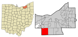
 Location in Cuyahoga County and the state of Ohio. |
||
 Location of Ohio in the United States |
||
| Coordinates: 41°18′46″N 81°49′55″W / 41.31278°N 81.83194°WCoordinates: 41°18′46″N 81°49′55″W / 41.31278°N 81.83194°W | ||
| Country | United States | |
| State | Ohio | |
| County | Cuyahoga | |
| Township created | 1818 | |
| Village created | 1923 | |
| Incorporated | 1961 | |
| Government | ||
| • Type | Mayor-council | |
| • Mayor | Thomas Perciak (R) | |
| Area | ||
| • Total | 24.64 sq mi (63.82 km2) | |
| • Land | 24.63 sq mi (63.79 km2) | |
| • Water | 0.01 sq mi (0.03 km2) 0.04% | |
| Elevation | 932 ft (284.07 m) | |
| Population (2010) | ||
| • Total | 44,750 | |
| • Estimate (2015) | 44,668 | |
| • Density | 1,816.9/sq mi (701.5/km2) | |
| census | ||
| Time zone | EST (UTC-5) | |
| • Summer (DST) | EDT (UTC-4) | |
| Zip code | 44136, 44149 | |
| Area code(s) | 440 | |
| FIPS code | 39-75098 | |
| GNIS feature ID | 1065396 | |
| Website | strongsville.org | |
Strongsville is a city in Cuyahoga County, Ohio, United States, and a suburb of Cleveland. As of the 2010 census, the city population was 44,750. The city's nickname 'Crossroads of the Nation,' originated from the Baltimore and Ohio Railroad (B&O) intersecting with the Southwestern Electric Line that connected Cleveland and Wooster, Ohio. As the railroad line ceased operation in 1931, the motto and city seal have been adapted to reflect the modern day intersection of Interstate 71 and the Ohio Turnpike.
Strongsville officially became a township on February 25, 1818, a village in 1923, and was ultimately designated a city in 1961. Founded by settlers arriving in the newly purchased Connecticut Western Reserve, the city was named after John Stoughton Strong, the group's leader. Many of the main streets in the city are named after other principal figures and landowners from the city's history, e.g. Howe, Drake, Shurmer, Whitney.
In the mid-19th century, the Pomeroy House, then called The Homestead, was a stop on the underground railroad. Alanson Pomeroy, the home owner and a prominent Strongsville resident, concealed runaway slaves on his property. From this residence in Strongsville, the runaway slaves were taken to boats on Rocky River for passage to Canada.
In 1853, John D. Rockefeller's family moved to Strongsville. At the time, Rockfeller was only a child.
On April 11, 1965, an F4 tornado hit Strongsville; see 1965 Palm Sunday tornado outbreak.
Strongsville is located at 41°18′46″N 81°49′55″W / 41.31278°N 81.83194°W (41.312752, -81.831976).
...
Wikipedia

