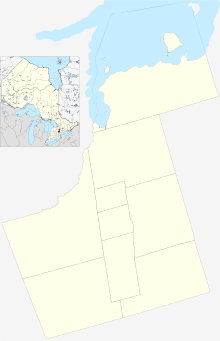
Stouffville, Ontario
| Stouffville | |
|---|---|
| Community | |
| Location within York | |
| Coordinates: 43°58′N 79°15′W / 43.967°N 79.250°WCoordinates: 43°58′N 79°15′W / 43.967°N 79.250°W | |
| Country |
|
| Province |
|
| Regional municipality | York Region |
| Town | Whitchurch–Stouffville |
| Incorporated | Village of Stouffville 1877 |
| Amalgamation (with Whitchurch Township) | January 1, 1971 |
| Government | |
| • Type | Municipality |
| • Mayor | Justin Altmann |
| • Councillors |
Rick Upton (Ward 4) Iain Lovatt (Ward 5) Rob Hargrave (Ward 6) |
| • MPP | Helena Jaczek |
| • MP | Jane Philpott |
| Area | |
| • Land | 14.87 km2 (5.74 sq mi) |
| Elevation | 266 m (873 ft) |
| Population (2011) | |
| • Total | 24,886 |
| • Density | 1,673.3/km2 (4,334/sq mi) |
| Time zone | Eastern Standard Time (EST) (UTC-5) |
| • Summer (DST) | Eastern Daylight Time (EDT) (UTC-4) |
| Forward sortation area | L4A |
| Area code(s) | 905 and 289 |
| NTS Map | 030M14 |
| GNBC Code | FCSZB |
| Website | www |
Stouffville (/ˈstoʊvɪl/) is the primary urban area within the town of Whitchurch–Stouffville, Ontario, Canada. It is centred at the intersection of Main Street, Mill Street and Market Street. Between 2006 and 2011, the population of the Community of Stouffville grew 100.5% from 12,411 to 24,886, or from 51% to 66% of the total population of the larger Town of Whitchurch–Stouffville.
Founded in 1804 by Abraham Stouffer, the hamlet was originally named Stoufferville. Stouffer built a sawmill and grist-mill on the banks of Duffin's Creek in the 1820s. The community name was shortened to Stouffville when its first post office opened in 1832.
In 1877, Stouffville became an incorporated village. On January 1, 1971, the Village of Stouffville amalgamated with Whitchurch Township and was designated a community within the larger town of Whitchurch–Stouffville; with amalgamation, the boundary of the town was also moved four farm lots south of the original boundary of Main Street (the land was formerly a part of Markham Township). The population of urban Stouffville in 1971 was 5,036.
In 2003, a large 16th-century Huron village was discovered in Stouffville during land development; approximately 2000 people once inhabited the site (Mantle Site), which included a palisade and more than 80 longhouses, yielding tens of thousands of artifacts.
Urban Stouffville is approximately 4.5 km long, stretching from the York-Durham Line to Highway 48, and approximately 2.7 km wide with development north and south of Main Street. Stouffville is bounded by farmland and a golf course. The community is located on the Oak Ridges Moraine and the Rouge River watershed.
...
Wikipedia

