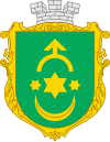
Stepan
|
Stepan Степань |
|||
|---|---|---|---|
| Urban-type settlement | |||
|
|||
| Location of Stepan in Ukraine | |||
| Coordinates: 51°07′42″N 26°18′15″E / 51.12833°N 26.30417°ECoordinates: 51°07′42″N 26°18′15″E / 51.12833°N 26.30417°E | |||
| Country |
|
||
| Province |
|
||
| District |
|
||
| Founded | 1861 | ||
| Town status | 1980 | ||
| Government | |||
| • Town Head | Volodymyr Sydorchuk | ||
| Area | |||
| • Total | 3.33 km2 (1.29 sq mi) | ||
| Elevation | 164 m (538 ft) | ||
| Population (2001) | |||
| • Total | 4,073 | ||
| • Density | 1,200/km2 (3,200/sq mi) | ||
| Time zone | EET (UTC+2) | ||
| • Summer (DST) | EEST (UTC+3) | ||
| Postal code | 34560 | ||
| Area code | +380 3655 | ||
| Website | http://rada.gov.ua/ | ||
Stepan (Ukrainian: Степань; Polish: Stepań; Hebrew: סטפאן) is an urban-type settlement in the Sarny Raion (district) of Rivne Oblast (province) in western Ukraine. Its population is 4,073 as of the 2001 Ukrainian Census. The settlement is located in the historic Volhynia region of Ukraine, on the left bank of the Horyn, a tributary of the Prypiat.
The first written mention of Stepan dates back to 1290. In 1900, the Jewish population of Stepan totaled 1,854. During the World War II occupation of Ukraine, the Nazi German occupying forces established a Jewish ghetto, where nearly 3000 Jews were killed. In 1960, Stepan acquired the status of an urban-type settlement.
...
Wikipedia


