Stenungsund
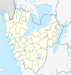
| Stenungsund, Sweden | |
|---|---|

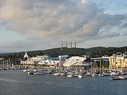
Stenungsund guest harbour in August 2010
|
|
| Coordinates: 58°05′N 11°49′E / 58.083°N 11.817°ECoordinates: 58°05′N 11°49′E / 58.083°N 11.817°E | |
| Country | Sweden |
| Province | Bohuslän |
| County | Västra Götaland County |
| Municipality | Stenungsund Municipality |
| Area | |
| • Total | 11.12 km2 (4.29 sq mi) |
| Population (31 December 2010) | |
| • Total | 9,987 |
| • Density | 898/km2 (2,330/sq mi) |
| Time zone | CET (UTC+1) |
| • Summer (DST) | CEST (UTC+2) |
Stenungsund is a locality and the seat of Stenungsund Municipality, Västra Götaland County, Sweden with 9,987 inhabitants in 2010.
Stenungsund was once only an idyllic bathing and vacation location on the Swedish west coast. A landmark is the Tjörn Bridge, a bridge to the island Tjörn.
The annual long distance sailing competition Tjörn Runt starts in Stenungsund.
Archaeological excavations in Stenungsund in 2006 discovered a site of Iron Age burials (1st - 3rd century AD), notable for the unusual presence of Roman ceramic artefacts.
Stenungsund was host of the Tug-of War championship in 2008.
Stenungsund holds the largest chemical cluster of its kind in Sweden, producing plastic in primary forms and basic chemicals. The name Stenungsund comes from the village stenunge that was located where central stenungsund now exists. Historians believe the name meant "the village at the foot of the mountain." The village had several names including Staenungum, Steffningsbyn and lastly Stännung.
The following sports clubs are located in Stenungsund:
...
Wikipedia


