Stamford, Vermont
| Stamford, Vermont | |
|---|---|
| Town | |
 Stamford, Vermont |
|
| Location in the United States | |
| Coordinates: 42°46′12″N 73°4′48″W / 42.77000°N 73.08000°WCoordinates: 42°46′12″N 73°4′48″W / 42.77000°N 73.08000°W | |
| Country | United States |
| State | Vermont |
| County | Bennington |
| Area | |
| • Total | 39.6 sq mi (102.6 km2) |
| • Land | 39.5 sq mi (102.3 km2) |
| • Water | 0.1 sq mi (0.3 km2) |
| Elevation | 1,804 ft (550 m) |
| Population (2010) | |
| • Total | 824 |
| • Density | 21/sq mi (8.1/km2) |
| Time zone | Eastern (EST) (UTC-5) |
| • Summer (DST) | EDT (UTC-4) |
| ZIP code | 05352 |
| Area code(s) | 802 |
| FIPS code | 50-69775 |
| GNIS feature ID | 1462215 |
| Website | stamfordvt |
Stamford is a town in Bennington County, Vermont, United States. The population was 824 at the 2010 census.
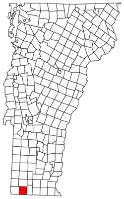
Stamford is located near the southwestern corner of Vermont, on the Massachusetts state line. To the south of Stamford lie the towns of Clarksburg and Florida, Massachusetts. Stamford is also bordered by the Vermont towns of Pownal to the west, Readsboro to the east, and Woodford to the north.
According to the United States Census Bureau, the town has a total area of 39.5 square miles (102.3 km2), of which 39.5 square miles (102.4 km2) is land and 0.12 square miles (0.3 km2), or 0.29%, is water.
Two state-maintained routes share a concurrency through Stamford: Vermont Route 8 and Vermont Route 100. They are the only state highways through town, and both have their southern terminus at the Massachusetts state line.
As of the census of 2000, there were 813 people, 313 households, and 235 families residing in the town. The population density was 20.6 people per square mile (7.9/km2). There were 387 housing units at an average density of 9.8 per square mile (3.8/km2). The racial makeup of the town was 98.52% White, 0.25% Native American, 0.37% Asian, and 0.86% from two or more races. Hispanic or Latino of any race were 0.25% of the population.
...
Wikipedia

