St. Peter's, Nova Scotia
|
St. Peter's Gaelic: Baile Pheadair |
|
|---|---|
| Village | |
 |
|
| Nickname(s): Gateway to the Bras d'Or The Village on the Canal |
|
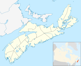
| Location of St Peter's, Nova Scotia | |
| Coordinates: 45°39′52″N 60°52′33″W / 45.664555°N 60.875744°W | |
| Country |
|
| Province |
|
| Municipality | Richmond County |
| Founded | 1650 |
| Government | |
| • Village Chair | Esther McDonnell |
| • Village Committee | Commissioners of St. Peter's |
| Area | |
| • Total | 346.8 km2 (133.9 sq mi) |
| Highest elevation | 38 m (125 ft) |
| Lowest elevation | 0 m (0 ft) |
| Population (2001) | |
| • Total | 2,634 |
| • Density | 7.6/km2 (20/sq mi) |
| Time zone | AST (UTC-4) |
| Postal code span | B0E 3B0 |
| Area code(s) | 902 |
| Telephone Exchange | 535 |
| Website | visitstpeters.com |
St. Peter's (Scottish Gaelic: Baile Pheadair; formerly known as "Santo Pedro", "Saint-Pierre", "Port Toulouse", and "St. Peters") is a small incorporated village located on Cape Breton Island in Richmond County, Nova Scotia, Canada.
This village is located on a narrow isthmus which separates the southern end of Bras d'Or Lake, known as St. Peter's Inlet, to the north from St. Peter's Bay on the Atlantic Ocean to the south. The isthmus is crossed by the St. Peters Canal which is almost exclusively used by pleasure boats in recent decades.
It is home to Battery Provincial Park.This park is situated on a hillside overlooking St. Peter’s Bay adjacent to the St. Peter’s Canal National Historic Site. Its entrance is on the east side of the bridge at the canal. Battery features a small saltwater beach (unsupervised), an interpretive display, picnic area with ocean frontage, and 3 kilometres /1.8 millimetres of hiking trails.
St. Peter's is also located on Trunk 4, one of the province's trunk or secondary highways. An expressway, Highway 104, is scheduled to be extended from its present terminus several kilometres west of St. Peter's to Sydney. When this occurs, Highway 104 will carry the Trans-Canada Highway designation on Cape Breton Island, for which Highway 105 is now designated.
The Nicholas Denys Museum is located in the village, but is only open in the summer. St. Peter's used to be served by a Canadian National Railways branchline which was abandoned in the early 1980s.
St. Peter's is one of North America's oldest European establishments. Prior to the arrival of the French, it was a Portuguese trading and fishing post named Santo Pedro in the 16th century. It was abandoned by Portugal in the early 17th century, and taken over by France in the 1630s when a small fortified settlement named Saint-Pierre (again named for Saint Peter) was built by merchants from La Rochelle, France on the isthmus. In 1650, La Rochelle merchant Nicholas Denys took possession of Saint-Pierre and encouraged the fur trade with local members of the Mi'kmaq Nation who used the isthmus as a canoe portage route between the Atlantic Ocean and Bras d'Or Lake. In addition to establishing a fur trading post, Denys later used the isthmus as a "haulover road" for portaging small sailing ships from Bras d'Or Lake to the Atlantic and vice versa.
...
Wikipedia

