St. Catharines
| St. Catharines | |||||
|---|---|---|---|---|---|
| City (lower-tier) | |||||
| City of St. Catharines | |||||

From top left: The corner of St. Paul and Queen streets, the Silver Spire United Church on St. Paul, a ship traversing the Welland Canal with the Garden City Skyway in the background, the lighthouse of Port Dalhousie, the Arthur Schmon Tower of Brock University, and the gazebo in Montebello Park
|
|||||
|
|||||
| Nickname(s): The Garden City, St. Kitts | |||||
| Motto: Industry and Liberality | |||||
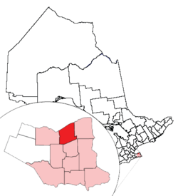
 Location of St. Catharines and its census metropolitan area in Ontario |
|||||
| Location of St. Catharines in Southern Ontario | |||||
| Coordinates: 43°11′N 79°14′W / 43.183°N 79.233°WCoordinates: 43°11′N 79°14′W / 43.183°N 79.233°W | |||||
| Country |
|
||||
| Province |
|
||||
| Region | Niagara | ||||
| Settled | 1783 | ||||
| Incorporated | 1845 (town) | ||||
| 1876 (city) | |||||
| Government | |||||
| • Mayor | Walter Sendzik | ||||
| • Governing body | St. Catharines City Council | ||||
| • MPs | Chris Bittle, Vance Badawey, Dean Allison | ||||
| • MPPs | Jim Bradley, Cindy Forster | ||||
| Area | |||||
| • Land | 96.11 km2 (37.11 sq mi) | ||||
| • Urban | 378.68 km2 (146.21 sq mi) | ||||
| • Metro | 1,397.51 km2 (539.58 sq mi) | ||||
| Elevation | 97.80 m (320.87 ft) | ||||
| Population (2011) | |||||
| • City (lower-tier) | 131,400 (Ranked 36th) | ||||
| • Density | 1,367.2/km2 (3,541/sq mi) | ||||
| • Urban | 309,319 (Ranked 12th) | ||||
| • Urban density | 816.8/km2 (2,116/sq mi) | ||||
| • Metro | 392,184 (Ranked 12th) | ||||
| • Metro density | 280.6/km2 (727/sq mi) | ||||
| Time zone | Eastern (EST) (UTC−5) | ||||
| • Summer (DST) | EDT (UTC−4) | ||||
| Postal code | L2M-L2W, L0S | ||||
| Area code(s) | 905, 289, 365 | ||||
| Highways |
|
||||
| Website | stcatharines |
||||
St. Catharines (2011 population 131,400; metropolitan population 392,184) is the largest city in Canada's Niagara Region and the sixth largest urban area in Ontario, with 96.11 square kilometres (37.1 sq mi) of land. It lies in Southern Ontario, 51 kilometres (32 mi) south of Toronto across Lake Ontario, and is 19 kilometres (12 mi) inland from the international boundary with the United States along the Niagara River. It is the northern entrance of the Welland Canal. Residents of St. Catharines are known as St. Cathariners.
St. Catharines carries the official nickname "The Garden City" due to its 1,000 acres (4 km2) of parks, gardens and trails.
St. Catharines is located between the Greater Toronto Area (GTA) and the Fort Erie – US border. Manufacturing is the city's dominant industry, as noted by the heraldic motto, "Industry and Liberality". General Motors of Canada, Ltd., the Canadian subsidiary of General Motors, was the city's largest employer, a distinction now held by the District School Board of Niagara. TRW Automotive operates a plant in the city, though in recent years employment there has shifted from heavy industry and manufacturing to services.
St. Catharines lies on one of the main telecommunications backbones between Canada and the United States, and as a result a number of call centres operate in the city.
The city was first settled by Loyalists in the 1780s. The Crown granted them land in compensation for their services and for losses in the United States. Early histories credit Serjeant Jacob Dittrick and Private John Hainer, formerly of Butler's Rangers, as among the first to come to the area. They took their Crown Patents where Dick's Creek and 12 Mile Creek merge, now the city centre of St. Catharines. Although never documented, some local St. Catharines historians speculate that Dick's Creek was named after Richard Pierpoint, a Black Loyalist and former American slave. Secondary to water routes, native trails provided transportation networks, resulting in the present-day radial road pattern from the City centre. The surrounding land was surveyed and Townships created between 1787 and 1789.
...
Wikipedia


