St. Bruno de Montarville, Quebec
| Saint-Bruno-de-Montarville | ||
|---|---|---|
| City | ||
 |
||
|
||
| Motto(s): Fiers de nos traditions (French for "Proud of our traditions") |
||
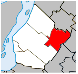
 Location within the urban agglomeration of Longueuil |
||
| Coordinates: 45°32′N 73°21′W / 45.533°N 73.350°WCoordinates: 45°32′N 73°21′W / 45.533°N 73.350°W | ||
| Country |
|
|
| Province |
|
|
| Region | Montérégie | |
| RCM | None | |
| Agglomeration | Longueuil | |
| Founded | 1842 | |
| Constituted | January 1, 2006 | |
| Government | ||
| • Mayor | Martin Murray | |
| • MP | Michel Picard (Lib) | |
| • MNA | Nathalie Roy (CAQ) | |
| Area | ||
| • Total | 43.30 km2 (16.72 sq mi) | |
| • Land | 43.28 km2 (16.71 sq mi) | |
| Population (2011) | ||
| • Total | 26,107 | |
| • Density | 603.3/km2 (1,563/sq mi) | |
| • Dwellings | 10,166 | |
| Demonym(s) | Montarvillois,(e) (French) | |
| Time zone | EST (UTC−5) | |
| • Summer (DST) | EDT (UTC−4) | |
| Area code(s) | 450 and 579 | |
| Highways |
|
|
| Website | www |
|
Saint-Bruno-de-Montarville is an off-island suburb of Montreal, in southwestern Quebec, Canada, on the south bank of the Saint Lawrence River just east of Montreal. It lies on the west flank of Mont Saint-Bruno, one of the Monteregian Hills. The population as of the Canada 2011 Census was 26,107. It merged with Longueuil in 2002 but de-merged in 2006.
The city is well known to Montrealers and its neighbouring population for Mont Saint-Bruno, location to both Mont-Saint-Bruno National Park and Ski Mont Saint-Bruno, a ski facility and school.
There are two prevailing hypotheses on the origin of the city's name:
Pierre Boucher de Boucherville Junior was granted the Montarville seigneury in 1710 by the governor of New France Philippe de Rigaud de Vaudreuil. In 1723, it was noted that clearing had not begun and no one was inhabiting the seigneury yet.
The ownership remained in the Boucher family until 1829, when René Boucher de la Bruère sold half his land and his rights as a seigneur to François-Pierre Bruneau of Montréal. He died in 1851 and his brother Oliver-Théophile Bruneau (who was the first professor of anatomy at McGill University), was the last seigneur of Montarville from 1851 until the seigneural system was abolished in 1854.
While agriculture was the primary subsistence and economical activity of the region, the seigneury of Montarville, thanks to its proximity to Mount Saint-Bruno, benefited much from the industrial activity that developed around the hydraulic power it could harvest from the mountain's many ponds and streams. The first water mill was erected in 1725 and in the 19th century, they numbered six in the territory and permitted such activities as grinding grain, milling wood, tanning leather and carding and spinning wool.
...
Wikipedia


