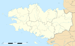
Spézet
|
Spézet Speied |
||
|---|---|---|

The town hall in Spézet
|
||
|
||
| Coordinates: 48°11′34″N 3°42′55″W / 48.1928°N 3.7153°WCoordinates: 48°11′34″N 3°42′55″W / 48.1928°N 3.7153°W | ||
| Country | France | |
| Region | Brittany | |
| Department | Finistère | |
| Arrondissement | Châteaulin | |
| Canton | Carhaix-Plouguer | |
| Intercommunality | Haute Cornouaille | |
| Government | ||
| • Mayor (2014–2020) | Gilbert Nigen | |
| Area1 | 60.67 km2 (23.42 sq mi) | |
| Population (2008)2 | 1,844 | |
| • Density | 30/km2 (79/sq mi) | |
| Time zone | CET (UTC+1) | |
| • Summer (DST) | CEST (UTC+2) | |
| INSEE/Postal code | 29278 / 29540 | |
| Elevation | 45–315 m (148–1,033 ft) | |
|
1 French Land Register data, which excludes lakes, ponds, glaciers > 1 km² (0.386 sq mi or 247 acres) and river estuaries. 2Population without double counting: residents of multiple communes (e.g., students and military personnel) only counted once. |
||
1 French Land Register data, which excludes lakes, ponds, glaciers > 1 km² (0.386 sq mi or 247 acres) and river estuaries.
Spézet (Breton: Speied) is a commune in the Finistère department of Brittany in north-western France.
Spézet is a rural municipality in east central Finistère, historically belonging to Cornwall. It is bounded on the west and north by the river the Aulne and Hyères describing large meanders (Nantes-Brest Canal-channel) while at the southeast end of its territory lies Roc'h Toullaëron, which from its height of 318 m is the culmination of the Black Mountains. The village occupies a small hill whose altitude is around 100 meters northwest of the town. The neighboring towns are named St. Hernin (east), Gourin (southeast), Roudouallec (south), St. Goazec (southwest), Châteauneuf-du-Faou (west), Plonévez-du-Faou (northeast) Landeleau and west and north Cléden-Poher.
During the Revolt of the Bonnets Rouges ("Red Caps") in 1675, the parishioners involved in the ransacking of the Kergoet castle in Saint-Hernin, owned by the Marquis Le Moyne de Trevigny. The parish is to pay 5000 livres as damages and repairs to the said Marquis for the injury. Four residents of the parish were excluded from the amnesty of 1676.
In 1770, according to Jean-Baptiste Ogée, the parish lands were uncultivated in many parts, especially in the mountains where the soil, poor quality, did not allow residents to take advantage of it. The land was actually good in the north of the parish.
In September and October 1779, an outbreak of dysentery caused about 150 victims in Spézet. Bodies had to be buried without entering the church for fear of contagion, under penalty of a fine of 20 livres.
June 24, 1944, ten resistants arrested in Spézet were shot in Lanvénégen after being sentenced to death by the German military court sitting in Le Faouët.
Inhabitants of Spézet are called in French Spézetois.
...
Wikipedia


