Southampton Township, New Jersey
| Southampton Township, New Jersey | |
|---|---|
| Township | |
| Township of Southampton | |

Bishop-Irick Farmstead in Vincentown
|
|
 Southampton Township highlighted in Burlington County. Inset map: Burlington County highlighted in the State of New Jersey. |
|
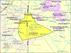
 Census Bureau map of Southampton Township, New Jersey |
|
| Coordinates: 39°54′58″N 74°43′04″W / 39.916236°N 74.717766°WCoordinates: 39°54′58″N 74°43′04″W / 39.916236°N 74.717766°W | |
| Country |
|
| State |
|
| County | Burlington |
| Incorporated | March 10, 1845 as Coaxen Township |
| Renamed | April 1, 1845 as Southampton Township |
| Government | |
| • Type | Township |
| • Body | Township Committee |
| • Mayor | James F. Young Sr. (term ends December 31, 2016) |
| • Administrator / Clerk | Kathleen D. Hoffman |
| Area | |
| • Total | 44.224 sq mi (114.538 km2) |
| • Land | 43.668 sq mi (113.099 km2) |
| • Water | 0.556 sq mi (1.439 km2) 1.26% |
| Area rank | 44th of 566 in state 7th of 40 in county |
| Elevation | 36 ft (11 m) |
| Population (2010 Census) | |
| • Total | 10,464 |
| • Estimate (2015) | 10,337 |
| • Rank | 234th of 566 in state 14th of 40 in county |
| • Density | 239.6/sq mi (92.5/km2) |
| • Density rank | 493rd of 566 in state 34th of 40 in county |
| Time zone | Eastern (EST) (UTC-5) |
| • Summer (DST) | Eastern (EDT) (UTC-4) |
| ZIP code | 08088 |
| Area code(s) | 609 exchanges: 268, 801, 859 |
| FIPS code | 3400568610 |
| GNIS feature ID | 0882090 |
| Website | www |
Southampton Township is a township in Burlington County, New Jersey, United States. As of the 2010 United States Census, the township's population was 10,464 reflecting an increase of 76 (+0.7%) from the 10,388 counted in the 2000 Census, which had in turn increased by 186 (+1.8%) from the 10,202 counted in the 1990 Census.
What is now Southampton was originally incorporated as Coaxen Township by an act of the New Jersey Legislature on March 10, 1845, from portions of Northampton Township (now known as Mount Holly Township). The name lasted for about three weeks when it was renamed Southampton Township on April 1, 1845. Portions of the township were taken to form Pemberton Township (March 10, 1846), Shamong Township (February 19, 1852), Lumberton Township (March 14, 1860), Woodland Township (March 7, 1866) and Tabernacle Township (March 22, 1901).
According to the United States Census Bureau, Southampton Township had a total area of 44.224 square miles (114.538 km2), including 43.668 square miles (113.099 km2) of land and 0.556 square miles (1.439 km2) of water (1.26%). The township is located within the New Jersey Pine Barrens.
Leisuretowne (2010 Census population of 3,582) is an unincorporated community and census-designated place (CDP) located within Southampton Township.Vincentown is an unincorporated area and ZIP code 08088 within portions of the township, while other unincorporated communities, localities and place names located partially or completely within the township include Beaverville, Buddtown, Burrs Mill, Chairville, Crescent Heights, Ewansville, Ewingville, Hampton Lakes, Medford Park, Oak Shade, Red Lion, Retreat and Sandtown.
...
Wikipedia
