South Saint Paul, Minnesota
| South St. Paul, Minnesota | |
|---|---|
| City | |
| City of South St. Paul | |

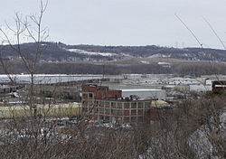
View across the industrial neighborhood by the Mississippi River
|
|
| Nickname(s): S.S.P. | |
| Motto(s): | |
 Location of the city of South St. Paul within Dakota County, Minnesota |
|
| Coordinates: 44°53′17″N 93°2′44″W / 44.88806°N 93.04556°W | |
| Country | United States |
| State | Minnesota |
| County | Dakota |
| South St. Paul | January 1, 1887 |
| Government | |
| • Type | Mayor (Municipal) |
| • Mayor | Jimmy Francis |
| Area | |
| • Total | 6.14 sq mi (15.90 km2) |
| • Land | 5.65 sq mi (14.63 km2) |
| • Water | 0.49 sq mi (1.27 km2) |
| Elevation | 719 ft (219 m) |
| Population (2010) | |
| • Total | 20,160 |
| • Estimate (2016) | 20,217 |
| • Density | 3,300/sq mi (1,300/km2) |
| Time zone | Central (CST) (UTC-6) |
| • Summer (DST) | CDT (UTC-5) |
| ZIP codes | 55075, 55076 |
| Area code(s) | 651 |
| FIPS code | 27-61492 |
| GNIS feature ID | 0652339 |
| Website | City of South St. Paul |
South St. Paul is a city in Dakota County, Minnesota, immediately south and southeast of the city of Saint Paul, Minnesota. It is also southeast of West St. Paul, Minnesota. The population was 20,160 at the 2010 census. It is notable as one of the historic major meat packing cities in the United States. Subsequently, many residents are descendants of immigrants from Southern Europe and Eastern Europe.
A post office called South St. Paul has been in operation since 1888. The city was named from its location south of St. Paul.
According to the United States Census Bureau, the city has a total area of 6.14 square miles (15.90 km2), of which 5.65 square miles (14.63 km2) is land and 0.49 square miles (1.27 km2) is water.
Interstate Highway 494, U.S. Highway 52, and Minnesota State Highway 156 are three of the main routes in South St. Paul.
South St. Paul is home to a small general aviation airport, Fleming Field.
The main industry for much of South St. Paul's history was the Saint Paul Union Stockyards. These remain active but much reduced in size, and much of the stockyards area is being redeveloped.
As of 04/11/2008, the stockyards are closed.
As of the census of 2010, there were 20,160 people, 8,186 households, and 5,065 families residing in the city. The population density was 3,568.1 inhabitants per square mile (1,377.7/km2). There were 8,666 housing units at an average density of 1,533.8 per square mile (592.2/km2). The racial makeup of the city was 85.3% White, 3.9% African American, 0.8% Native American, 1.2% Asian, 0.1% Pacific Islander, 5.4% from other races, and 3.4% from two or more races. Hispanic or Latino of any race were 12.2% of the population.
...
Wikipedia

