South-Link Line
| South-Link Line | |
|---|---|
 |
|
| Overview | |
| Native name | 南迴線 |
| Type | Passenger/freight rail |
| Termini |
Fangliao Taitung |
| Stations | 14 |
| Operation | |
| Opened | 16 December 1991 |
| Owner | Taiwan Railways Administration |
| Operator(s) | Taiwan Railways Administration |
| Technical | |
| Line length | 98.2 km (61.0 mi) |
| Number of tracks | 1 |
| Track gauge | 3 ft 6 in (1,067 mm) |
| Operating speed | 150 km/h (93 mph) |
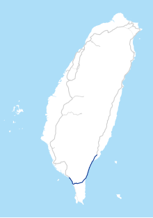
The South-Link Line (Chinese: 南迴線; pinyin: Nánhuí Xiàn) is a line of the Taiwan Railways Administration running along the southern tip of the island of Taiwan, connecting the eastern and western coasts. It is 98.2 km long, of which 81.4 km is single track.
The South-Link Line was completed in 1991, making it the newest standard rail line operated by the TRA, and creating an around-the-island railway network.
In August 2009, sections of the line were badly damaged by floods triggered by Typhoon Morakot. The line was reopened on December 30, 2009.
In September 2010, service was temporarily suspended due to Typhoon Fanapi. The Taimali River (Chinese: 太麻里溪) had risen substantially and washed away 100 m (330 ft) of railway embankment. The line was reopened on September 29, 2010. The Taiwan Railway Administration plans to spend an additional NT$240 million on a double-tracked, 520 m (1,710 ft) bridge over the Taimali River to avoid future problems with flooding.
Note: Central Signal Station - Guzhuang Station passes through Daren of Taitung County, but there is no station set up.
...
Wikipedia
