Sortland
| Sortland kommune | |||
|---|---|---|---|
| Municipality | |||

View of Sortland from Strandheia mountain.
|
|||
|
|||
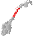
 Sortland within Nordland |
|||
| Coordinates: 68°42′31″N 15°16′51″E / 68.70861°N 15.28083°ECoordinates: 68°42′31″N 15°16′51″E / 68.70861°N 15.28083°E | |||
| Country | Norway | ||
| County | Nordland | ||
| District | Vesterålen | ||
| Administrative centre | Sortland | ||
| Government | |||
| • Mayor (30.10.2015) | Tove Mette Bjørkmo (AP) | ||
| Area | |||
| • Total | 722.37 km2 (278.91 sq mi) | ||
| • Land | 698.22 km2 (269.58 sq mi) | ||
| • Water | 24.15 km2 (9.32 sq mi) | ||
| Area rank | 152 in Norway | ||
| Population (2012) | |||
| • Total | 9,983 | ||
| • Rank | 105 in Norway | ||
| • Density | 14.3/km2 (37/sq mi) | ||
| • Change (10 years) | 6.1 % | ||
| Demonym(s) | Sortlending | ||
| Time zone | CET (UTC+1) | ||
| • Summer (DST) | CEST (UTC+2) | ||
| ISO 3166 code | NO-1870 | ||
| Official language form | Neutral | ||
| Website | www |
||
|
|
|||
![]() Sortland is a town and municipality in Nordland county, Norway. It is part of the traditional region of Vesterålen. The administrative centre of the municipality is the town of Sortland. Other population centres in Sortland include Bø, Holand, Holmstad, Liland, Sigerfjord, and Strand. The Norwegian Coast Guard has its northern base in Sortland, called Kystvaktskvadron Nord.
Sortland is a town and municipality in Nordland county, Norway. It is part of the traditional region of Vesterålen. The administrative centre of the municipality is the town of Sortland. Other population centres in Sortland include Bø, Holand, Holmstad, Liland, Sigerfjord, and Strand. The Norwegian Coast Guard has its northern base in Sortland, called Kystvaktskvadron Nord.
In 1997, the municipality decided to declare "township" for Sortland. Sortland is the largest town and commercial centre in Vesterålen. Sortland is located close to the Sortland Bridge, connecting Langøya to Hinnøya by road. Since a lot of houses in the town are painted blue, Sortland is sometimes referred to as "the blue city". In January 2012, the number of citizens in Sortland reached 10,000.
...
Wikipedia


