Somerdale
| Somerdale, New Jersey | |
|---|---|
| Borough | |
| Borough of Somerdale | |
 Somerdale highlighted in Camden County. Inset: Location of Camden County in New Jersey. |
|
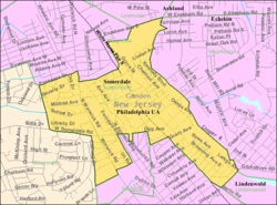
 Census Bureau map of Somerdale, New Jersey |
|
| Coordinates: 39°50′43″N 75°01′18″W / 39.845391°N 75.021701°WCoordinates: 39°50′43″N 75°01′18″W / 39.845391°N 75.021701°W | |
| Country |
|
| State |
|
| County | Camden |
| Incorporated | April 23, 1929 |
| Government | |
| • Type | Borough |
| • Body | Borough Council |
| • Mayor | Gary J. Passanante (D, term ends December 31, 2019) |
| • Administrator | Victor Cantillo |
| • Municipal clerk | Michele Miller |
| Area | |
| • Total | 1.387 sq mi (3.592 km2) |
| • Land | 1.387 sq mi (3.592 km2) |
| • Water | 0.000 sq mi (0.000 km2) 0.00% |
| Area rank | 462nd of 566 in state 26th of 37 in county |
| Elevation | 85 ft (26 m) |
| Population (2010 Census) | |
| • Total | 5,151 |
| • Estimate (2016) | 5,506 |
| • Rank | 372nd of 566 in state 22nd of 37 in county |
| • Density | 3,714.0/sq mi (1,434.0/km2) |
| • Density rank | 169th of 566 in state 22nd of 37 in county |
| Time zone | Eastern (EST) (UTC-5) |
| • Summer (DST) | Eastern (EDT) (UTC-4) |
| ZIP code | 08083 |
| Area code(s) | 856 |
| FIPS code | 3400768340 |
| GNIS feature ID | 0885396 |
| Website | www |
Somerdale is a borough in Camden County, New Jersey, United States. As of the 2010 United States Census, the borough's population was 5,151, reflecting a decline of 41 (-0.8%) from the 5,192 counted in the 2000 Census, which had in turn declined by 248 (-4.6%) from the 5,440 counted in the 1990 Census.
The Borough of Somerdale was created on April 23, 1929, from Clementon Township, one of seven municipalities created from the now-defunct township, and one of five new municipalities (including Hi-Nella Borough, Lindenwold Borough, Pine Hill Borough and Pine Valley Borough) created on that same date.
According to the United States Census Bureau, the borough had a total area of 1.387 square miles (3.592 km2), all of which was land.
Somerdale borders the Camden County municipalities of Cherry Hill, Gloucester Township, Hi-Nella, Lawnside, Lindenwold, Magnolia, Stratford, Voorhees Township.
As of the 2010 United States Census, there were 5,151 people, 2,026 households, and 1,345 families residing in the borough. The population density was 3,714.0 per square mile (1,434.0/km2). There were 2,158 housing units at an average density of 1,556.0 per square mile (600.8/km2). The racial makeup of the borough was 68.20% (3,513) White, 18.99% (978) Black or African American, 0.08% (4) Native American, 6.00% (309) Asian, 0.02% (1) Pacific Islander, 3.07% (158) from other races, and 3.65% (188) from two or more races. Hispanic or Latino of any race were 8.19% (422) of the population.
...
Wikipedia
