Solan
|
Solan सोलन |
|
|---|---|
| Major City | |

From top, left to right: Thodo dance of Solan; Shoolini Utsav; Shoolini Devi Temple Solan; Yung Drung Monastery, Dholanji, Solan; panoramic view of Solan city
|
|
| Nickname(s): Mushroom city of India | |
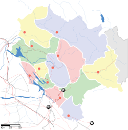
| Location in Himachal Pradesh | |
| Coordinates: 30°54′18″N 77°05′49″E / 30.905°N 77.097°ECoordinates: 30°54′18″N 77°05′49″E / 30.905°N 77.097°E | |
| Country | |
| State | Himachal Pradesh |
| District | Solan |
| Government | |
| • MLA | Dhani Ram Shandil |
| Area | |
| • Total | 33.43 km2 (12.91 sq mi) |
| Area rank | Largest City of Himachal Pradesh, urban planning area wise |
| Elevation | 1,502 m (4,928 ft) |
| Population | |
| • Total | 39,256 |
| • Rank | 2nd largest city of Himachal Pradesh |
| • Density | 300/km2 (800/sq mi) |
| Languages | |
| • Official | English |
| • Regional | Pahari, Hindi |
| Time zone | IST (UTC+5:30) |
| PIN | 173212 |
| Telephone code | 01792 |
| Vehicle registration | HP 14, HP 01S, HP 02S, HP 64, HP 59 |
| Avg. annual temperature | 18 °C (64 °F) |
| Avg. summer temperature | 32 °C (90 °F) |
| Avg. winter temperature | −2 °C (28 °F) |
| Website | hpsolan |
Solan is the district headquarters of Solan district (created on 1 September 1972) in the Indian state of Himachal Pradesh. The largest Municipal Council of Himachal Pradesh, it is located 46 kilometres (29 mi) south of the state capital, Shimla. At an average elevation of 1,600 metres (5,200 ft). The place is named after the Hindu goddess Shoolini devi. Every year in the month of June, a fair celebrating the goddess is held, featuring a 3-day mela at the central Thodo grounds. Solan was the capital of the erstwhile princely state, Bhagat.
It is known as the "Mushroom city of India" because of the vast mushroom farming in the area as well as the Directorate of Mushroom Research (DMR) situated at Chambaghat. Solan is crowned as the "City of Red Gold", in reference to the bulk production of tomatoes in the area. The town is situated between Chandigarh (joint capital of Punjab and Harayana) and Shimla (state capital), on the Kalka-Shimla National Highway-22. The Kalka-Shimla narrow gauge heritage railway line, built by the British passes through Solan and is a recognised World Heritage site.
The history of Solan goes back to the era of Pandavas. According to local folklore, Pandavas lived here during their exile. In 1815 British won Baghat state (now Solan) from the Gurkhas, Gurkha fort or Arki Fort is still standing tall on a mountain near to Solan city and it is one of the popular historic tourist attractions of Solan. The town has been a capital of the princely Baghat State. The word Baghat is derived from Bau or Bahu, meaning "many", and Ghat meaning "pass". Initially the state headquarters of the Baghat State was located at Bhoch in the Bhuchali pargana, but the headquarters of the state was shifted to Solan after the construction of cantonment over here. The railway was set up in 1902. The evolution of Solan city can be understood in the following order or sequence :-
...
Wikipedia


