Smyth County
| Smyth County, Virginia | ||
|---|---|---|

Smyth County Courthouse in Marion
|
||
|
||
 Location in the U.S. state of Virginia |
||
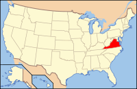
 Virginia's location in the U.S. |
||
| Founded | 1832 | |
| Named for | Alexander Smyth | |
| Seat | Marion | |
| Largest town | Marion | |
| Area | ||
| • Total | 452 sq mi (1,171 km2) | |
| • Land | 451 sq mi (1,168 km2) | |
| • Water | 1.4 sq mi (4 km2), 0.3% | |
| Population (est.) | ||
| • (2015) | 31,470 | |
| • Density | 70/sq mi (27/km²) | |
| Congressional district | 9th | |
| Time zone | Eastern: UTC-5/-4 | |
| Website | www |
|
Smyth County is a county located in the U.S. state of Virginia. As of the 2010 census, the population was 32,208. Its county seat is Marion.
Smyth County was formed on February 23, 1832, from Washington and Wythe counties. The county is named after Alexander Smyth, a general during the War of 1812 who was elected to the state Senate, House of Delegates, and as a Representative to the United States Congress.
According to the U.S. Census Bureau, the county has a total area of 452 square miles (1,170 km2), of which 451 square miles (1,170 km2) is land and 1.4 square miles (3.6 km2) (0.3%) is water.
As of the census of 2000, there were 33,081 people, 13,493 households, and 9,607 families residing in the county. The population density was 73 people per square mile (28/km²). There were 15,111 housing units at an average density of 33 per square mile (13/km²). The racial makeup of the county was 96.86% White, 1.87% Black or African American, 0.15% Native American, 0.18% Asian, 0.32% from other races, and 0.60% from two or more races. 0.86% of the population were Hispanic or Latino of any race.
...
Wikipedia

