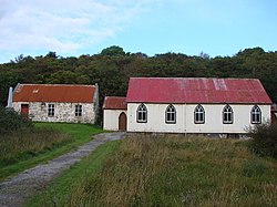
Skerray
Skerray
|
|
|---|---|
 |
|
| Skerray shown within the Sutherland area | |
| OS grid reference | NC661628 |
| Council area | |
| Country | Scotland |
| Sovereign state | United Kingdom |
| Post town | Thurso |
| Postcode district | KW14 7 |
| Police | Scottish |
| Fire | Scottish |
| Ambulance | Scottish |
| EU Parliament | Scotland |
Skerray (Scottish Gaelic: Sgeirea) is a remote small crofting hamlet and fishing port on the north coast of Sutherland, Scotland. It is located 7.7 miles (12.4 km) by road northeast of Tongue and 40.2 miles (64.7 km) by road west of Thurso. Skerray is home to a community of artists and a group of tree planters.
Skerray, whose name means "between the rocks and the sea", is so called because it is situated on a rocky promontory on the Atlantic Ocean between Tongue to the southwest and Bettyhill to the east. There is an additional location called Skerray 1 mile (1.6 km) to the west. The community is located north of the A836 road from Tongue. The nearest local airport and main line rail station are at Wick and Thurso.
Skerray is the main village in 'Mackay Country', historically attributed to Clan Mackay. There are 11 townships in the community, Torrisdale, Achtoty, Lotts, Clashaidy, Clashlevan, Achnabat, Clashbuie, Modsary, Lamigo, Stathanbeg, Strathan, and Slettel, now deserted. To the south are the lakes of Lochan Modsane, Loch na Coit, Lochan nam Burag, Lochan an Tigh-choimhid and Loch Skerray, with Lochan Ruadh to the southwest. Just off the coast of Skerray Bay is Neave Island and Eilean nan Ron to the northwest.
Skerray Bay contains a small harbour and pier. The harbour, situated west of Melvich, has a natural rocky ridge, open to the north. The foundation stone for Port Skerray was laid in October 1894 by the Duke of Sutherland. The Skerray stream, Strathskerray, is approximately 3 miles (4.8 km) in length and empties at the sea.
...
Wikipedia

