Skanör med Falsterbo
| Skanör med Falsterbo | ||
|---|---|---|

Old part of Falsterbo
|
||
|
||
| Coordinates: 55°24′N 12°51′E / 55.400°N 12.850°ECoordinates: 55°24′N 12°51′E / 55.400°N 12.850°E | ||
| Country | Sweden | |
| Province | Scania | |
| County | Skåne County | |
| Municipality | Vellinge Municipality | |
| Area | ||
| • Total | 5.42 km2 (2.09 sq mi) | |
| Population (31 December 2010) | ||
| • Total | 6,937 | |
| • Density | 1,280/km2 (3,300/sq mi) | |
| Time zone | CET (UTC+1) | |
| • Summer (DST) | CEST (UTC+2) | |
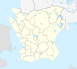
Skanör med Falsterbo is a statistical locality (Swedish tätort, locality code 3672), situated in Vellinge Municipality, Skåne County, Sweden with 6,937 inhabitants in 2010. It consists of the two old towns of Skanör and Falsterbo which have grown together, but are still regarded as different communities by locals. The preposition med means with. Thanks to its southerly and maritime position, the locality is the mildest in Sweden, with winter lows barely averaging frosts.
It is a conurbation consisting of the two medieval towns of Skanör and Falsterbo. Both towns are located on the elongated reef-like western part of the Falsterbo Peninsula, (Falsterbonäset), Falsterbo to the south and Skanör to the north. The towns are separated by a several kilometers long bank built of earth and seaweed, and have never geographically been considered the same town.
The peninsula forms the southwesternmost tip of the Scandinavian Peninsula. It marks the border between the Baltic Sea and the Øresund, the sound that separates the Danish island Zealand from the southern Swedish province of Scania.
The locality is situated south of the city of Malmö, with 28 km to Skanör and 30 km to Falsterbo, based on the local distance signs along the motorway. During the 20th century the towns have become affluent suburbs for people working in the Malmö-Lund region, as well as a popular site among older people who have retired from higher positions abroad or in the capital.
...
Wikipedia


