Sisters, Oregon
| Sisters, Oregon | |
|---|---|
| City | |

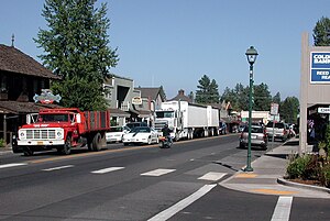
Cascade Avenue in downtown Sisters
|
|
| Motto: "A Modern Western Community" | |
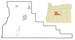
 Location in Oregon |
|
| Coordinates: 44°17′27″N 121°32′56″W / 44.29083°N 121.54889°WCoordinates: 44°17′27″N 121°32′56″W / 44.29083°N 121.54889°W | |
| Country | United States |
| State | Oregon |
| County | Deschutes |
| Incorporated | 1946 |
| Government | |
| • Mayor | Chris Frye |
| Area | |
| • Total | 1.87 sq mi (4.84 km2) |
| • Land | 1.87 sq mi (4.84 km2) |
| • Water | 0 sq mi (0 km2) |
| Elevation | 3,182 ft (970 m) |
| Population (2010) | |
| • Total | 2,038 |
| • Estimate (2012) | 2,118 |
| • Density | 1,089.8/sq mi (420.8/km2) |
| Time zone | Pacific (UTC-8) |
| • Summer (DST) | Pacific (UTC-7) |
| ZIP code | 97759 |
| Area code(s) | 541 |
| FIPS code | 41-67950 |
| GNIS feature ID | 1127008 |
| Website | www.ci.sisters.or.us |
Sisters is a city in Deschutes County, Oregon, United States. It is part of the Bend, Oregon Metropolitan Statistical Area. The population was 959 at the 2000 census, but more than doubled to 2038 as of the 2010 census.
The community takes its name from the nearby Three Sisters mountains.
According to the United States Census Bureau, the city has a total area of 1.87 square miles (4.84 km2), all of it land.
The Santiam Highway (U.S. Route 20) and the McKenzie Highway (Oregon Route 126) merge briefly to form Cascade Avenue, the main thoroughfare through downtown Sisters. On Cascade Avenue, there is a lot of pedestrian traffic and many specialty stores and galleries. East of Sisters the two highways split, with 126 heading to Redmond and 20 going to Bend. West of Sisters, the road splits once more, with the McKenzie Highway becoming Oregon Route 242 and running west over the McKenzie Pass (a summertime-only scenic route over the Cascades.) The Santiam Highway proceeds over the Santiam Pass.
This region experiences warm (but not hot) and dry summers, with no average monthly temperatures above 71.6 °F (22.0 °C). According to the Köppen Climate Classification system, Sisters has a warm-summer Mediterranean climate, abbreviated "Csb" on climate maps.
...
Wikipedia
