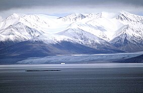
Sirmilik National Park
| Sirmilik National Park | |
|---|---|
|
IUCN category II (national park)
|
|
 |
|
|
Location of the park in Baffin Island, Canada
|
|
| Location | Nunavut, Canada |
| Nearest city | Pond Inlet |
| Coordinates | 72°59′26″N 81°08′14″W / 72.9906°N 81.13732°WCoordinates: 72°59′26″N 81°08′14″W / 72.9906°N 81.13732°W |
| Area | 22,200 km2 (8,600 sq mi) |
| Established | 2001 |
| Governing body | Parks Canada |
| http://pc.gc.ca/pn-np/nu/sirmilik/index_e.asp | |
Sirmilik National Park (/ˈsɜːrməlɪk/; Inuktitut: "the place of glaciers") is a protected area located in Qikiqtaaluk, Nunavut, Canada, established in 1999. Situated within the Arctic Cordillera, the park is composed of three areas: most of Bylot Island with the exception for a few areas that are Inuit-owned lands, Oliver Sound, and Baffin Island's Borden Peninsula. Much of the park is bordered by water.
Geographically, it is representative of the Northern Eastern Arctic Lowlands Natural Region as well as parts of the Lancaster Sound Marine Region. Sirmilik is part of the National parks of Canada.
In the Inuktitut (or Inuit language, traditionally spoken across the North American Arctic) Sirmilik means "place of glaciers," as it represents Bylot Island's plethora of glaciers and ice caps. As Canadian Arctic Inuktitut-speakers referred to northern Baffin Island as Sirmilik, the name of the geographic region became the name of the national park.
Extensive archaeological exploration of the park area has indicated that the area has been inhabited by humans for thousands of years. The earliest known are predecessors of the modern-day Inuit.
The area was explored by European whalers and by explorers in their search for the Northwest Passage. In the 1610s, the area was surveyed by British explorers William Baffin and Robert Bylot. They named several features of the area including Lancaster Sound and Bylot Island in 1616. It was 200 years before the next official attempt to find the Passage through this area. The expedition by the British explorer John Ross in 1818 confirmed the accuracy of Baffin's charts, but ended when he saw what he believed were mountains blocking the end of Lancaster Sound. The area was later thoroughly explored during an extensive aerial mapping program of Northern Canada by the Canadian Government which took from the 1930s until the late 1950s to complete.
...
Wikipedia

