Singrauli district
|
Singrauli district सिंगरौली जिला |
|
|---|---|
| District of Madhya Pradesh | |
| Country | India |
| State | Madhya Pradesh |
| Administrative division | Rewa |
| Headquarters | Waidhan |
| Tehsils | deosar, Chitrangi, singrauli, mada, sarai |
| Government | |
| • Lok Sabha constituencies | Sidhi |
| • Assembly seats | 1. Chitrangi 2. Singrauli 3. Deosar |
| Area | |
| • Total | 5,672 km2 (2,190 sq mi) |
| Population (2011) | |
| • Total | 1,178,132 |
| • Density | 210/km2 (540/sq mi) |
| Demographics | |
| • Literacy | 62.36 per cent |
| • Sex ratio | 916 |
| Major highways | NH 75 |
| Website | Official website |
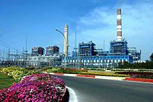
| power plant in Singrauli District | |
|---|---|
 |
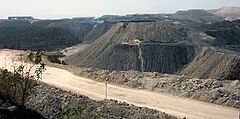
| ncl coal mines | |
|---|---|
 |
| power plant in Singrauli | |
|---|---|
 |
| ganesh temple, deosar | |
|---|---|
 |
Singrauli district is one of the districts in the India state of Madhya Pradesh.
Singrauli district came into existence on 24 May 2008, with its headquarters at Waidhan. It was formed by separating three tehsils of the erstwhile Sidhi district: Singrauli, Deosar and Chitrangi.
Singrauli district covers an area of 5,672 square kilometres (2,190 sq mi).
Singrauli district comprises three tehsils, namely, Singrauli, Deosar and Chitrangi.
There are three Madhya Pradesh Vidhan Sabha constituencies in this district, namely, Chitrangi, Singrauli and Deosar. All of these are part of Sidhi Lok Sabha constituency Later two more tehsils have been added to this district viz. Mada and Sarai.
According to the 2011 census Singrauli district has a population of 1,178,132, roughly equal to the nation of Timor-Leste or the US state of Rhode Island. This gives it a ranking of 402nd in India (out of a total of 640). The district has a population density of 208 inhabitants per square kilometre (540/sq mi) . Its population growth rate over the decade 2001-2011 was 28.03%. Singrauli has a sex ratio of 916 females for every 1000 males, and a literacy rate of 62.36%.
The Rihand Dam was built in 1961 across the Rihand River at Pipri in the neighbouring district of Sonbhadra, in Uttar Pradesh. Later, rich coal deposits spread over an area of 2,200 square kilometres (850 sq mi) across the states of Uttar Pradesh and Madhya Pradesh were discovered close to the artificial lake, Govind Ballabh Pant Sagar formed by the Rihand Dam. That led to the transformation and development of the area.
...
Wikipedia
