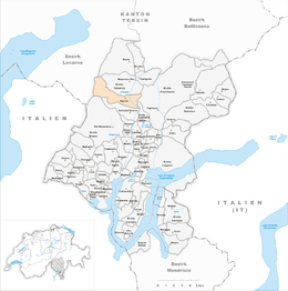
Sigirino
| Sigirino | ||
|---|---|---|
| Former municipality of Switzerland | ||
|
||
| Coordinates: 46°5′N 8°55′E / 46.083°N 8.917°ECoordinates: 46°5′N 8°55′E / 46.083°N 8.917°E | ||
| Country | Switzerland | |
| Canton | Ticino | |
| District | Lugano | |
| Area | ||
| • Total | 8.71 km2 (3.36 sq mi) | |
| Elevation | 470 m (1,540 ft) | |
| Population | ||
| • Total | 596 | |
| • Density | 68/km2 (180/sq mi) | |
| Postal code | 6806 | |
| SFOS number | 5223 | |
| Surrounded by | Alto Malcantone, Capriasca, Indemini, Mezzovico-Vira, Ponte Capriasca, Rivera, Torricella-Taverne, Vira (Gambarogno) | |
| Website | SFSO statistics |
|
Sigirino is a former municipality in the district of Lugano in the canton of Ticino in Switzerland. The municipalities of Medeglia, Bironico, Camignolo, Rivera and Sigirino merged on 21 November 2010 into the new municipality of Monteceneri.
Sigirino is first mentioned in 1335 as Sezelino. In the Middle Ages, Sigirino belonged to the territory of the Carvina valley community. Carvina included all the villages in the upper Vedeggio valley and its secular and religious capital was Bironico. In a land register of 1296, Como Cathedral posseessed lands, pastures, forests, farmland and land with houses in Sigirino. It is likely that at that time Sigirino possessed some type of fortifications.
The Church of St. Andrew was first mentioned in 1296. It was totally rebuilt in the 16th Century and restored in the 18th. After its separation from Bironico in 1625, Sigirino had its own parish.
Economically, the village was dominated by agriculture and emigration. In the 21st Century, it belongs to commercial and industrial zone in the valley floor between Sigirino and the neighboring villages.
Sigirino has an area, as of 1997[update], of 8.71 square kilometers (3.36 sq mi). Of this area, 0.31 km2 (0.12 sq mi) or 3.6% is used for agricultural purposes, while 6.89 km2 (2.66 sq mi) or 79.1% is forested. Of the rest of the land, 0.57 km2 (0.22 sq mi) or 6.5% is settled (buildings or roads), 0.1 km2 (25 acres) or 1.1% is either rivers or lakes and 0.76 km2 (0.29 sq mi) or 8.7% is unproductive land.
Of the built up area, housing and buildings made up 1.1% and transportation infrastructure made up 3.4%. Power and water infrastructure as well as other special developed areas made up 1.4% of the area Out of the forested land, 64.4% of the total land area is heavily forested, while 13.1% is covered in small trees and shrubbery and 1.6% is covered with orchards or small clusters of trees. Of the agricultural land, 1.8% is used for growing crops and 1.1% is used for alpine pastures. All the water in the municipality is flowing water. Of the unproductive areas, 7.3% is unproductive vegetation and 1.4% is too rocky for vegetation.
...
Wikipedia


