Sierra de Perijá National Park
| Sierra de Perijá National Park Perijá National Park |
|
|---|---|
|
IUCN category II (national park)
|
|

Perijá National Park
|
|
|
Location in Venezuela
|
|
| Location | Venezuela |
| Nearest city | Maracaibo |
| Coordinates | 9°32′0″N 73°0′0″W / 9.53333°N 73.00000°WCoordinates: 9°32′0″N 73°0′0″W / 9.53333°N 73.00000°W |
| Area | 295,288 hectares (729,670 acres) |
| Established | 1978 |
| Governing body | Instituto Nacional de Parques(INPARQUES) ’’National Park Institute’’ |
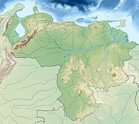
Sierra de Perijá National Park, also known as Perijá National Park, is a protected area in Venezuela. It is located in the Serranía de Perijá mountains on the border with Colombia, to the southwest of Zulia state and Lake Maracaibo. The park was established in 1978 with the objective of protecting the hilly regions.
Sierra de Perijá National Park is situated in the Perija and Colon municipalities of Zulia State. The park is accessible by road from Maracaibo.
The park includes a portion of the Serranía de Perijá mountains, which rises above the southwestern area of Lake Maracaibo, a large brackish bay connected to the Gulf of Venezuela. The highest elevation is Pico Tétar at 3,500 metres (11,500 ft). It covers an area of 295,288 hectares (729,670 acres).
The vegetation in the park consists mainly of rainforest, cloud forests, highland moors and sub-alpine and alpine tundra. Some typical trees include Anacardium excelsum, wax palms Ceroxylon, Cecropia, Gyranthera caribensis, Tabebuia chrysantha, T. billbergii, T. chrysea and Podocarpus oleifolius and there are many herbs, flowering plants and bromeliads.
The wildlife in the park includes spectacled bear, as well as capuchin and howler monkeys.Dolphins in Lake Maracaibo are proposed to be brought under a protection programme through the South American River Dolphin Protected Area Network.
...
Wikipedia

