Shoshone National Forest
| Shoshone National Forest | |
|---|---|
|
IUCN category VI (protected area with sustainable use of natural resources)
|
|

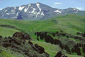
Francs Peak is the tallest peak in the Absaroka Range
|
|
| Location | Park, Fremont, Hot Springs, Sublette, and Teton counties, Wyoming, US |
| Nearest city | Cody, WY |
| Coordinates | 44°27′52″N 109°36′49″W / 44.46444°N 109.61361°WCoordinates: 44°27′52″N 109°36′49″W / 44.46444°N 109.61361°W |
| Area | 2,466,909 acres (9,983.23 km2) |
| Established | March 3, 1891 |
| Visitors | 646,000 (in 2009) |
| Governing body | U.S. Forest Service |
| Website | Shoshone National Forest |
Shoshone National Forest (/ʃoʊˈʃoʊniː/ shoh-SHOH-nee) is the first federally protected National Forest in the United States and covers nearly 2,500,000 acres (1,000,000 ha) in the state of Wyoming. Originally a part of the Yellowstone Timberland Reserve, the forest is managed by the United States Forest Service and was created by an act of Congress and signed into law by U.S. President Benjamin Harrison in 1891. Shoshone National Forest is one of the first nationally protected land areas anywhere. Native Americans have lived in the region for at least 10,000 years, and when the region was first explored by European adventurers, forestlands were occupied by several different tribes. Never heavily settled or exploited, the forest has retained most of its wildness. Shoshone National Forest is a part of the Greater Yellowstone Ecosystem, a nearly unbroken expanse of federally protected lands encompassing an estimated 20,000,000 acres (8,100,000 ha).
The Absaroka and Beartooth Mountains are partly in the northern section of the forest. The Wind River Range is in the southern portion and contains Gannett Peak, the tallest mountain in Wyoming.Yellowstone National Park forms part of the boundary to the west; south of Yellowstone, the Continental Divide separates the forest from its neighbor Bridger-Teton National Forest to the west. The eastern boundary includes privately owned property, lands managed by the U.S. Bureau of Land Management and the Wind River Indian Reservation, which belongs to the Shoshone and Arapahoe Indians. Custer National Forest along the Montana border is on the northern frontier. The Oregon Trail, the 19th century covered wagon route, passes just south of the forest, where broad and gentle South Pass allowed the migrants to bypass the rugged mountains to the north.
...
Wikipedia

